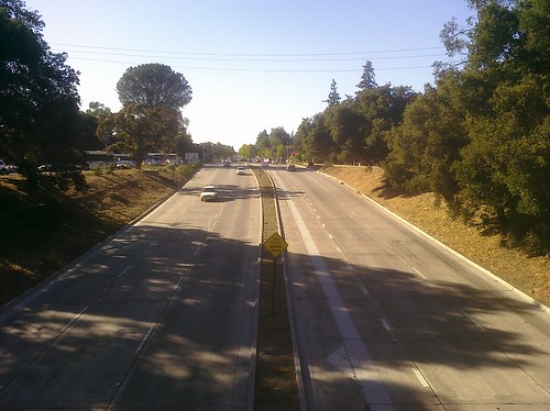
Last November I took a bus ride up El Camino Real from San Jose to San Francisco and blogged my impressions and observations. To avoid giving myself whiplash, that day I only looked out the right side of the bus at the eastern side of the street and doggedly ignored the left side so the job was only half done. Last Friday, September 3, 2010, I completed the task, taking the reverse bus trip from San Francisco down to San Jose, observing the west side. Back in November I scribbled all my notes on the bus by hand in a notebook and ended up taking four months to type them all up. It’s not that I’m a slow typist, it’s just that the scope of the project was much larger than I anticipated. For the second trip I found a more efficient way: I live-tweeted my journey.
If you’re unfamiliar with tweeting, it means I used my cell phone on the road to type and send text messages to the Twitter service. Twitter messages, or “tweets,” are limited to 140 characters each so it enforces brevity. A great advantage is that every message was timestamped and geocoded by GPS so I have a complete record of what I saw, when I saw it, and where I was. I tried to live in the moment and just write what was on my mind which means whatever happened to catch my eye out the bus window. I know it’s a pretty pedestrian read (irony intended) but I hope I conveyed a sense of El Camino’s diverse profile.

Below are my 167 tweets from that day from my brand new @allcamino twitter account. It took some effort to extract them all from Twitter’s web site. There are web apps that do this but they didn’t work for me because they rely on Twitter’s search engine which failed me, returning only six tweets (?!). I wrote a Perl script to convert their HTML to the format I wanted for the blog. To improve the readability I put each time stamp and location stamp against the right margin above each tweet. You can click the location links to open a Google map. My live-tweeting strategy worked great. Last year it took me four months to finish the writeup. Here I’ve done it in less than four days.
I cleaned the text up, fixing obvious two-left-thumb typos and grammar issues, but the content is largely raw and uncut. I’ve put a few editor notes in [square] brackets and added hyperlinks for your reference. I’ve written broader post-trip comments in between tweets in italics. You’ll see a bunch of the photos I took, many from the windows of the buses. Please excuse their quality.
9:04 AM
On the road! Touring El Camino Real again, in the other direction today.
9:21 AM from McKay – Ringwood, San Jose
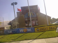
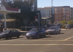
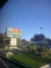
McD’s for breakfast. Flapjacks and meat cake.
9:24 AM from McKay – Ringwood, San Jose
Oh…One ✓McDonalds! One! Ah ah ah ah!
My homage to Sesame Street’s The Count. Just like in the original trip, I counted various fast food stores, grocery stores, gas stations, etc., as I passed them. I also counted El Camino Real marker bells. Well it’s wrong to say I counted them; rather I just tweeted them when I saw them, intending to count them later. I’ve marked them here with ✓checkmarks for clarity.
9:27 AM from McKay – Ringwood, San Jose
Just realized our neighborhood PW Market is closing. Not sure about other stores. So sad.
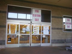
The PW Market at Oakland & Brokaw has been struggling for a while and I just realized that morning that they had finally put up “store closing” signs. This is heartbreaking; I’ve been shopping here since I moved here. The parent company is closing all its stores.
9:33 AM from San Jose, CA
Checked the bus schedule. When’s the next 66 coming? Oh, in one minute! Nom nom. Gulp gulp. Run run. Made it!
I got to the bus stop 1 minute before the #66 bus. Remember that fact.
9:33 AM from San Jose, CA
Crossed train tracks at Wayne Station.
9:35 AM from Milpitas, CA
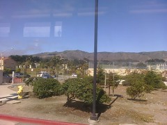
Crossed Montague. Mihalakis. Approaching Great Mall. In Milpitas now.
9:37 AM from Milpitas, CA
Little burrito place by the biker bar is long gone. These light rail tracks weren’t here when I moved here.
Just reflecting on recent changes in the area.
9:37 AM from Milpitas, CA
Live tweeting by phone is harder than I thought
It took some getting used to, trying to observe out the window and thumb-type at the same time. Before long I got the hang of it.
9:38 AM from Milpitas, CA
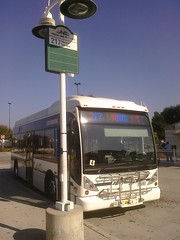
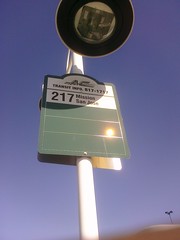
Arrived at Gr Mall, AC Transit 217 is here waiting.
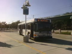
9:41 AM from Milpitas, CA
#217 leaves in 10 minutes. Perfect.
9:44 AM from Milpitas, CA
Going to sit in a forward-facing seat on the passenger side near the back. Not used to seeing rear-facing seats on a bus.
I had some time so I engaged in some exposition for folks following along at home.
9:45 AM from Milpitas, CA
217 will take me up Mission Blvd past Mission San Jose to Fremont BART. Then I’ll take BART to SF, MUNI, SamTrans, & VTA down El Camino.
9:46 AM from Milpitas, CA
More or less the counter-clockwise version of the trip I took in November.
9:47 AM from Milpitas, CA
Haha, the 217 bus stop is labeled “Mission San Jose!” not BART, not Fremont. Beautifully poetic.
9:52 AM from Milpitas, CA
VTA 180 just left for Fremont BART. I’m taking 217 instead because it’s cheaper, slower, and takes Mission Blvd or El Camino de San Jose
The VTA 180 costs twice as much but gets to BART twice as fast because it takes I-680 instead of surface streets. Of course I preferred to take the scenic route.
9:54 AM from Milpitas, CA
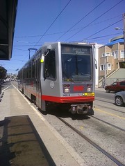
Boarded the 217. Paid $2 with my new Clipper Card. BTW I paid $6 cash for a VTA day pass earlier. Got the seat I wanted.
I had just bought a Clipper Card the week prior. It’s a stored-value card good for some, but not all, regional transit agencies. VTA has installed readers but they’re not activated yet so I had to pay cash.
9:57 AM from Milpitas, CA
✓Taco Bell. Jain Center. Great Jump. Baja Cactus Mex food. “Green one.” (That’s for my son. Punch!). Turned onto Serra. Yes, as in Junipero.
The Serra Shopping Center is here, adjacent to Junipero Street and Serra Street, an homage to the Padre Presidente.
10:00 AM from Milpitas, CA
On Abel now. Lampposts at Abel Plaza look like ECR bells. Turning onto Calaveras. Over Main, train tracks. De Anza trail marker.
The lampposts hang from crooks, similar to the El Camino historic bell markers. Every time I pass them I notice the resemblance.
10:05 AM from Milpitas, CA
Signs for Hemp Con. Los Coches (oink!). Indian Community Center. Ah so *that’s* where it is. Never been there. On Milpitas Blvd now.
Los Coches”The Pigs”was a nearby Mexican land grant rancho. A street commemorates the name.
10:06 AM from Milpitas, CA
Passed City Hall. ✓Safeway. Crossed a Creek, Berryessa I think.
10:10 AM from Milpitas, CA
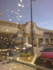
Crossed Abel/Jacklin. Fire house. 2nd ✓✓Subway. N. Milpitas Blvd. ✓Gas Station. City Square Shopping Ctr. ✓McD at Dixon Lndg.
10:12 AM from Milpitas, CA
I can see Monument Peak & Mission Peak from here. Lady is complaining to the driver about another driver. Guess she feels better now.
10:14 AM from Warm Springs, Fremont
Welcome to Milpitas sign. Alameda County Line. On Warm Springs now. Cedar Lawn cemetery. Mostly housing developments here, all walled.
As we left Milpitas I could see the “Welcome to Milpitas” sign for people going the other way, entering town. There are many houses here on Warm Springs but they face the other way so all you can see is their backyard walls and fences.
10:19 AM from Warm Springs, Fremont
In Fremont. Hi, @aboutfremont! Galleria. ✓Gas station. Warm Springs Grammar School. Mission Blvd. Franciscan Center: ✓gas, ✓Safeway
Shout out to a fellow hyperlocal twitterer. Franciscan Center is another shopping center paying homage to the Spanish missionaries.
10:24 AM from Warm Springs, Fremont
De Anza route marker. ✓BK. ✓Taco Bell. Gas. 680. More trees here. More walled houses. Paseo Padre. Passenger has Ohlone College shirt on.
10:27 AM from East Industrial, Fremont
Crossed Stanford [Avenue]. Leland’s brother had a vineyard here. Crossed a creek. Climbing now. Houses are set back from Mission. Wall has adobe look
Josiah Stanford, Governor Leland Stanford’s older brother. The wall here was built in a mission style with whitewashed bricks and red tiles on top.
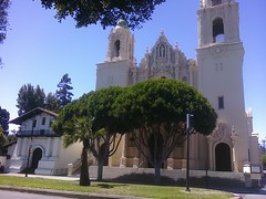
10:29 AM from Mission San Jose, Fremont
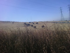
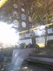
Mission Heights dev[elopment] has bell. Turning into Ohlone College. Passed sign for Mission Peak trail. Another for Ohlone trail. Cows!
The sign for the Mission Heights development has a full-sized mission bell in it.
10:32 AM from Mission San Jose, Fremont
In the hills, awesome view of Bay to the west. Ohlone blends nicely into the hillside, dry but golden brown. Lot of students boarding.
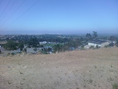
I hadn’t realized Ohlone College had some elevation.
10:34 AM from Mission San Jose, Fremont
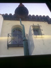
Guess they had an early class. Ooh, long weekend! Lampposts are straight up bells here! Like in Santa Clara. Mission district. Mission! ✓Bell
The street lights are literally El Camino bells with light bulbs in them. Santa Clara has them too. Unfortunately we zoomed right past Mission San Jose without even stopping. Oh well.
10:37 AM from Mission San Jose, Fremont
Creek. Park-like here. ✓Gas. Mission Estates. ✓McD. Mission Blvd & Mission Rd. 680. AC [Alameda County] Water District. Open space briefly.
10:40 AM from Mission Valley, Fremont
SF Water Dept? Castro. Houses set back by little street. More walls now but plenty trees. Fremont Community Church. Stevenson.
For a brief stretch the houses are front-facing and are separated from Mission Boulevard by a little side street and a tree-lined island. This way the driveways aren’t right on the busy boulevard. It gives an open, wide, “grand” feeling to the road, especially compared to the narrow walled corridor which follows.
10:45 AM from Cherry – Guardino, Fremont
Turning onto Walnut. Done with Mission Blvd I think. CA School for the Blind. Never knew this was here. Ramirez Farm. What is that, corn?
10:46 AM from Cherry – Guardino, Fremont
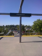
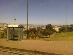
CA Lakepointe. Tule ponds and…Fremont BART.
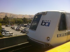
10:52 AM from Parkmont, Fremont
Clipper Card. Tap On! San Francisco Daly City train is here. And…we’re off!
At BART the Clipper Card is a two-tap system: tap when you enter and again when you leave. The fare is calculated based on how far you travel.
10:56 AM from Union City, CA
Not on El Camino anymore so I can relax. An Ohlone student on the bus was interested in my Solio. I guess she wondered why my phone was
10:58 AM from Union City, CA
plugged into my fanny pack. I should have asked what her friend was listening to. It was a weird little hand-held speaker, playing music.
Coincidentally later that day I saw the same little speaker for sale at Street Mrkt. It’s called the SkullyBoom SB1. Now for some exposition…
11:01 AM from Union City, CA
So the plan is to take BART to 16th St & Mission in San Francisco, then a combination of MUNI & BART to Daly City. El Camino is nebulous
11:03 AM from Whitman – Wocine, Hayward
in SF but I figure if I touch Mission St., Dolores, Church, and San Jose Ave I’ll have it covered. I’ve debated if Mission St. in SF counts
11:05 AM from Whitman – Wocine, Hayward
as ECR [El Camino Real]. I suppose it does, especially the part between Mission Dolores and downtown i.e. Yerba Buena.
There is no street called El Camino Real in San Francisco so it’s a matter of interpretation which streets serve that function. Here’s a fantastic account of Mission Street by Tom Graham who undertook and completed an amazing project to walk every street in San Francisco, all 2,603 of them. He says Mission Street is the longest, and he would know.
11:18 AM from Coliseum Industrial Complex, Oakland
D’oh! I shouted out @aboutfremont earlier when I meant @aroundfremont. So sorry. Oh well.
11:40 AM from Army Base, Oakland
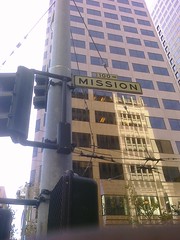
Made a snap decision. Since I convinced myself Mission St. counts as ECR I hopped off BART at Embarcadero Station.
11:41 AM from SoMa, San Francisco
I’ll take MUNI 14 from here down Mission to 16th St.
11:43 AM from SoMa, San Francisco
Clipper Card. Tap off! $5.60. A beeyootiful day in the city! Walking down Spear to Mission. Saw a cable car.
11:52 AM from South Beach, San Francisco
Boarded MUNI 14 at Fremont. Was going to wait at Spear but another driver told me to walk up 2 blocks. Whatever. Clipper card $1.75.
11:53 AM from South Beach, San Francisco
Cheaper than cash? 2nd St. We were just here last week! Academy of Art College. I hate that name. Is it Academy or College?
I now know the Clipper Card system automatically gave me the $0.25 discount for transferring from BART. My family and I cleverly vacationed in San Francisco in August and we stayed here in SOMA so I was familiar with the area.
11:57 AM from SoMa, San Francisco
Contemporary Jewish Museum. St. Patrick’s Church. City College. Everest College. Century Theater. Bloomingdales.
12:00 PM from SoMa, San Francisco
Grittier now, not so glam. Courthouse. Federal Building, unusual architecture. Announcement: MUNI Owl restores tomorrow.
They played a recorded announcement on the bus about MUNI’s newly expanded late night service.
12:03 PM from SoMa, San Francisco
PG&E substation. Just noticed bus has electric display with stop names. Slick. Pot clinic.
12:10 PM from SoMa, San Francisco
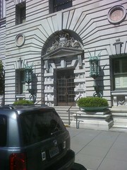
Goodwill Koret Retail Training Center. Mission turned south. Glimpsed Sutro Tower. Crossed 101. Imposing brick bldg at 14th St.
It’s the Armory Building, a Moorish Castle built in 1914.
12:10 PM from Mission, San Francisco
Off at 16th St.
12:15 PM from SoMa, San Francisco
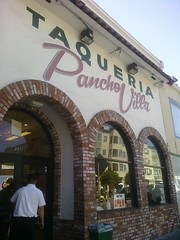
Walked up 16th St to Pancho Villa Taqueria, a fave of mine. Line’s out the door. Lunchtime. ¡Si, señor!
1:07 PM from Mission Dolores, San Francisco
Ordered chipotle prawns w/pinto beans & corn tortillas and a watermelon agua fresca. When I went to pay tho I told him I had garlic prawns
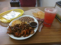
1:08 PM from Duboce Triangle, San Francisco
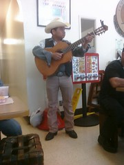
which is a dollar cheaper. Whoops! I explained and gave them the $1 on the way out. A mariachi player serenaded us. Prawns were
1:10 PM from Castro, San Francisco
delicious but (a) unshelled (pick, pick, pick) and (b) grilled with mushrooms. Yuck. I still enjoyed it but I’ll stick with tacos and
1:11 PM from Duboce Triangle, San Francisco
burritos next time. Used the restrooma lesson learned from my last El Camino trip. ‘Nuf said. Walked up 16th to Mission Dolores, #2 today!
1:13 PM from Duboce Triangle, San Francisco
On opposite corners here are St. Matthew’s Lutheran Church & Congregation Sha’ar Zahav. Hey, we’re just a block away from Church St.
Truth in advertising.
1:50 PM from Mission, San Francisco
Stepped into the mission store and bought myself the awesome shirt of many missions. Had a great chat with Cathy and Melba,
1:52 PM from Castro, San Francisco
the ladies who work there. We talked about Our Lady of Sorrows, mission projects, the Stanfords, architecture, and collecting.
I had been to the mission just the week before and had seen this shirt. I couldn’t bring myself to buy it then, but this time it seemed like a no-brainer. It really is an awesome shirt.
1:52 PM from Castro, San Francisco
I highly recommend visiting Mission Dolores. Tell Cathy and Melba allcamino.com sent you!
These ladies are great and have a lot of interesting information to share. Cathy told me they get 10,000 fourth graders a year touring the mission.
1:54 PM from Castro, San Francisco
Walked up to Church St. Waiting for the J Church metro to continue the journey. A Google Street View car just drove past.
2:01 PM from Castro, San Francisco
Boarded J Church. No seats, boo! Tweeting while standing. $1.75 again. Asked driver for a transfer. He said no. Got a seat after 2 stops.
With the Clipper Card, you don’t need a paper transfer.
2:03 PM from Noe Valley, San Francisco
Climbing through Dolores Park. Gorgeous view of SF and East Bay. I can probably see Ohlone College from here.
2:05 PM from Castro, San Francisco
Winding through lush vegetation and some lovely Victorians. One is painted like a rain forest.
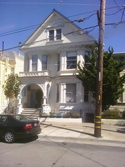
2:06 PM from Noe Valley, San Francisco
Descending now. Still Church St. I’m on the wrong side of the train but oh well. Moved over to correct side, riding backwards.
2:10 PM from Noe Valley, San Francisco
24th St. Cesar Chavez. I think this is Noe Valley now. St. Paul’s Catholic Church. Toast (minimalist). A lady’s bag fell out.
I think her bag fell out the rear door of the train as the doors were closing. She used the intercom to ask the driver to stop but he wouldn’t.
2:12 PM from Mission, San Francisco
30th St. Lady got off and has to run back to last stop to rescue her bag. MUNI operators don’t play. Turned onto San Jose. S[an] Jose & Dolores
2:15 PM from Mission, San Francisco
Fairmount, Escuela de Inmersion. I love obvious street names like “San Jose.” Whoa, this is almost a freeway, with Caltrans signs.
“Oakland Road.” “Monterey Highway.” Could it be any clearer?
2:19 PM from Mission Terrace, San Francisco
280 nearby. Squishy Sushi Eco Boutique. I see low fog on the hills, a break from the heat. Balboa Swimming pool. Balboa Park (the park).
2:23 PM from Mission Terrace, San Francisco
Roof is leaking!? Some seats are wet. Driver says everyone get off. Oh, could be condensation from A/C. No matter, we’re at Balboa Park BART
Hmm…I lost a tweet here, saying the driver just stopped half a block short so he could take the train out of service. I had a few moments where my phone couldn’t communicate with twitter, so I did lose some data.
2:27 PM from Sunnyside, San Francisco
Millbrae train was waiting. Sweet.
2:28 PM from Ingleside Heights, San Francisco
Have to take BART because it’s the easiest way to get to Top-of-the-Hill Mission St. in Daly City.
2:34 PM from Original Daly City, Daly City
Daly City. Brr! Engulfed in fog. Took a while to find the SamTrans 390 stop because the sign was obscured. Solio is almost dead.
2:38 PM from Original Daly City, Daly City
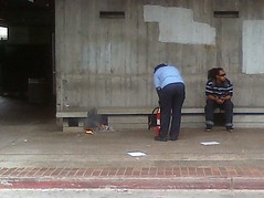
Guy on platform is practicing twirling chains. I was wondering if he twirls fire when I started smelling smoke! Nearby on the ground
He was spinning unlit poi.
2:39 PM from Ingleside Heights, San Francisco
some newspapers were burning! Maybe lit by a careless cigarette. Station attendant calmly extinguished it, making a mess.
2:40 PM from Ingleside Heights, San Francisco
Boarded 390, $2 cash fare. No Clipper Card yet. Daly City street signs are blue with a white bird. Love the 390. So cushy!
2:45 PM from Original Daly City, Daly City
Switching to my Energizer Energi To Go charger. Hope it lasts. Right on Mission St. Top of the Hill. Some high school I think, no sign.
It’s Jefferson.
2:47 PM from Original Daly City, Daly City
✓Midas. Phone batt[ery] down to 20% but climbing again. I think I’ll make it. Charles Gracie Jiu Jitsu. Chick-n-Coop Hof Brau.
To keep my phone charged for all this tweeting I brought my Solio solar charger and two Energizer Energi To Go chargers. As a last resort I had my laptop and I ended up using that to charge my phone at the end of the day.
2:50 PM from Original Daly City, Daly City
Passenger “entertaining” us with parental-advisory MP3s. Thanks. CA 82 sign. El Camino Real sign, first one today. Ah, Colma!
Pet peeve: people playing music out loud on the bus. Especially if it’s foul.
2:51 PM from Original Daly City, Daly City
That explains all the monument (tombstone) vendors. Subway. Colma BART, and…
2:53 PM from Colma, Colma
Cemeteries! Woodlawn. Green Lawn. Two ✓✓bells 20 yards apart!? Florists. Town Hall. Colma flag has town hall on it. Serramonte.
2:54 PM from Serramonte, Daly City
Cypress Lawn. Colma Creek. South San Francisco!
2:54 PM from Serramonte, Daly City
Still El Camino Real (no modifiers). ✓Bell at Hickey.
2:58 PM from El Camino, South San Francisco
Day in the Park coming up. Which park? Teenagers behind me are talking teenager talk. Happy place. Happy place. Turning into BART station.
Orange Memorial Park, four blocks from El Camino.
3:01 PM from El Camino, South San Francisco
South San Francisco BART. San Bruno Mountain behind it. We’re looping around so I won’t miss an inch of El Camino. 🙂
On the trip up in November the bus cut through the bus station, missing a block of El Camino. I felt cheated. This time we looped it so we hit that same stretch twice. I felt vindicated.
3:04 PM from El Camino, South San Francisco
Mission Rd parallel to ECR, Colma city limit there. Promenade housing development looks comfy from here. Nothing but hillside on this side.
I could see a Colma sign a block away, even though we were deep in South City. Strange.
3:06 PM from Serra Highlands, South San Francisco
✓KFC. South San Francisco Municipal Building. ✓Bell. ✓Kragen. ✓Gas.
3:07 PM from Avalon, South San Francisco
Gawd these teens are driving me nuts. I wish they would just text each other quietly. Commercial strip, but cool since we’re so high up.
I can’t even tell you what they were talking about. Just blah blah blah.
3:08 PM from El Camino, South San Francisco
Saw another Google Street View car! My second today and third in a week.
3:10 PM from Avalon, South San Francisco
Yay! Irritating teens got off. I feel like I’ve had a tumor removed. ✓McD. ✓Taco Bell. Saw civic signs, but we’re still in South City.
I later realized from my photo that the collection of civic signs had a ✓bell on top!
3:12 PM from El Camino, South San Francisco
And…more music. Sigh. At least it’s clean. Brentwood Bowl. ✓Gas. Sun’s in my face. Gonna be a long ride. 🙂
Unfortunately the sun stayed with me which made taking pictures out the bus window really difficult. Plus it was really warm.
3:14 PM from Avalon, South San Francisco
San Bruno! Street signs with bells on them. Military cemetery. Signs for VA Clinic are sadly ironic. ✓Gas. Tanforan Touch Free Laser Wash ?!?
A laser car wash. I have no idea what that even means. I want to try it. With somebody else’s car. Ah, there are no actual lasers involved; it’s a metaphor for high pressure water.
3:19 PM from San Bruno, CA
23rd Marines. 101. Well 380 really but signs say 101. Police action on a tricked-out sedan. San Bruno Public Library.
Three police cars had pulled over somebody in a sweet ride.
3:21 PM from San Bruno, CA
City hall. Fire station. ✓Bell. ✓Wendy’s. Here come the high school kids. This lot looks bookish. Maybe…nope. Just as irritating.
School was out so a new influx of students boarded. I had high hopes but these kids were incessant gigglers. Ugh. Hey, one of the perks of growing old is I’ve earned the right to be annoyed at stuff like this.
3:24 PM from San Bruno, CA
Dang, missed Tattoo Expo. House of Kegs. Right on. ✓Gas. Street signs changed. Must be…Millbrae.
Tattoo Expo at the Cow Palace was last month. House of Kegs: to the point.
3:27 PM from San Bruno, CA
Sweet Memories desserts palace. Yum! ✓Kragen. ✓McD. ✓Gas. 24 Hour Fitness Super Sport (above my membership level). Millbrae Square. ✓Safeway.
3:30 PM from Millbrae, Millbrae
✓Bell. ✓Gas. ✓Gas. Awkward bus stop at Hillcrest, inside set-off parking lane. Appealing strip of close-knit businesses. Pedestrian friendly.
3:35 PM from Millbrae, Millbrae
Turning on Millbrae Ave. Heavy traffic at 101. Millbrae Intermodal Station: BART, Caltrain.
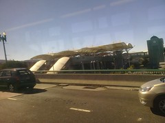
3:40 PM from Millbrae, Millbrae
Back to El Camino Real. Cool Millbrae neon sign. Former cinema? Comerica bank now. Another Google car. Seriously? Good thing I’m not paranoid
3:42 PM from Millbrae, Millbrae
And neither am I. Burlingame Plaza. ✓Subway. ✓Lucky. ✓Bell. Mills-Peninsula hospital. Giant eucalyptus trees.
3:47 PM from Burlingame Village, Burlingame
All walls and trees. Fences really, all wood. Small apartment buildings now, 60s era. Broadway. Broadway Business Center.
3:49 PM from Easton Addition, Burlingame
Mix of apartments and single family homes. ✓Bell at Floribunda. St. Paul’s Episcopal Church stands out. Sign for Auto Row.
3:52 PM from Downtown, Burlingame
Guy across from me is talking to his magazine. Preach, bro. San Mateo!
He would blurt out random passages and snide commentary from his magazine from time to time. It got pretty uncomfortable.
3:55 PM from Downtown, Burlingame
I’m doing much better spotting city limit signs this time. King of the road! Guy with magazine is getting more…emphatic.
On my first trip I had trouble knowing when I passed from city to city, but this time I found it much easier. I surprised myself by noticing the changes in the “El Camino” street signs since every city has its own design.
3:59 PM from Baywood – Aragon, San Mateo
Site of De Anza Exploration camp marker. San Mateo Public Library. Bank of America w/mural for A. P. Giannini, great character.
4:00 PM from Downtown, San Mateo
Now South El Camino Real. 24 Hour Fitness. Downtown but still apartments and houses on this side. St. Matthew’s Catholic Church.
4:04 PM from Hayward Park, San Mateo
Magazine man shouts, “a blunder by a CHILD MOLESTER!” Out of bounds friend. Cycle path, funny name. ✓McD. ✓Gas. 24 Hour Fitness. CA 92.
4:10 PM from Hillsdale, San Mateo
Closed gas station. ✓Gas. Close-set businesses. Taxi’s Hamburgers. Hmm… Hillsdale Shopping Center. California Welcome Center. Here?!
Mmm…burgers…
Seems like an odd place for a California Welcome Center. It’s not listed on their web site. Strange.
4:12 PM from Hillsdale, San Mateo
Apparently AC Transit comes out here. Wow. Route M. Farewell, Magazine Man. May I suggest the funny pages in the future.
4:16 PM from Hillsdale, San Mateo
✓Subway. Some of these side streets like 41st have little business strips. Who knew?
4:17 PM from Belmont, Belmont
Signs say El Camino Real now. Must mean…Belmont! ✓McD.
4:20 PM from Belmont, Belmont
Uh oh. Twitter prob[lem]s. Funny EL CAMINO real signs.
Big “EL CAMINO.” Little “real.”
4:22 PM from Belmont, Belmont
✓Safeway. Oh I see. They treat “real” as if it were “street.” Fail! Homey little strip here. Few parking lots, very inviting. ✓Subway.
I saw a sign that said “ONEILL ave” which makes sense. “EL CAMINO real” does not.
4:24 PM from California, US
A/C kicked on. Nice. Sun is really cooking me here. ✓McD. CreoLa. Gotta try it some day. Street signs changed…San Carlos!
✓Bell! I took the picture but forgot to tweet it.
4:29 PM from San Carlos, San Carlos
Lighthouse lamp fixtures. ✓Subway. ✓Gas. 1001 Laurel condos. ✓Gas. Businesses right up to sidewalks. I really like that design. ✓Jack in the box
My favorite look for El Camino is what I call the village design, where store fronts are right on the sidewalk with big glass shop windows, as opposed to being set back behind front parking lots. It’s pedestrian focused rather than car focused.
4:32 PM from San Carlos, San Carlos
Jack sells pastrami? What do they not sell? Thai Time clearly used to be something else. ✓Kragen. Urban Stylez clothing. Saddle Shop.
4:35 PM from Centennial, Redwood City
Hmm…back to EL CAMINO real signs. ✓Carl’s Jr. Redwood City city limit. Crossed a creek. ✓KFC. ✓Gas. Stacks. ✓Bell. ✓Gas.
4:37 PM from Oak Knoll – Redwood Park, Redwood City
“Sequoia” is a popular business name in these parts. Gelb Music. Sequoia High School. Broadway. I love how all these Broadways pale in
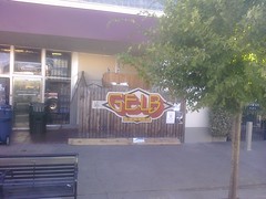
4:39 PM from Centennial, Redwood City
comparison to El Camino. Roy’s Drive-In cleaners…kinda isn’t. Movie Groove and Grind Coffee Bar look awfully hip. Next to Vibes Tattoos.
4:44 PM from Roosevelt, Redwood City
Holiday Inn Express has a cool bell fountain. ✓Wendy’s. Funky black and white street signs. ✓Bell. CA 84. Mel’s Bowl, gone? Ferrari dealership
4:46 PM from Fair Oaks, Atherton
Black and white signs again. Atherton city limit. Brown signs now. No more businesses. Wood fences shielding houses. Plenty of dense trees.
4:48 PM from Atherton, CA
White El Camino post stuck in the ground. No sidewalk. Creek. Menlo College, ergo Menlo Park. Brown street signs with oak trees on them.
4:52 PM from Menlo Park, CA
Menlo Park city limit. Boarded up theater. The first Round Table, celebrating 50 years! Santa Cruz Avenue.
4:53 PM from Menlo Park, CA
We’re playing leapfrog with a SamTrans route KX bus. Nearly hit it just now! Oak City Bar & Grill. The Guild theater. ✓Safeway.
4:57 PM from Downtown Menlo Park, Menlo Park
✓Gas. Green street signs. Oasis. San Francisquito Creek. Santa Clara County line. Palo Alto city limit. Stanford Shopping Center. Whew!
There’s a lot going on at that creek!
5:00 PM from Stanford University, Palo Alto
De Anza historic road marker. Turning onto University Ave. Palo Alto Caltrain. End of the line.
5:25 PM from Stanford University, Palo Alto
Took a breather. Walked around, stretched my legs and lungs. Took some photos around MacArthur Park, Hostess House.
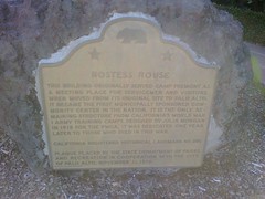
5:26 PM from Stanford University, Palo Alto
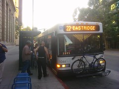
I thought about catching Marguerite to Stanford to get some food, but decided I didn’t want the delay. Hopped on VTA 22. Free w/day pass.
5:27 PM from Stanford University, Palo Alto
Yep, taking 22 instead of 522. Slower and easier to see out of non-wrapped windows. Stanford University. Palm Drive, Eucalyptus Grove.
I lost several tweets here when my phone couldn’t connect to Twitter. I mostly was calling out Stanford features like the stadium, the football schedule, etc.
5:35 PM from Stanford University, Palo Alto
✓Gas. ✓Jack in the box. (PITA to type.) I think my Energi To Go is depleted. Good thing I have another.
5:39 PM from Stanford University, Palo Alto
Soccer field. ✓Bell. Subway, as in tunnel under ECR. Gated off. ✓McD. ✓Taco Bell. ✓Gas. Buena Vista Mobil [sic] Home Park.
There’s a pedestrian walkway under the road similar to the one on The Alameda, but this one is closed.
5:43 PM from Charleston Meadow, Palo Alto
Zen Hotel. Wow. Closed car dealership. Hobees. Hotel Cabana. Welcome to Palo Alto sign. Brown street signs mean…Los Altos.
5:47 PM from North Los Altos, Los Altos
Rambus. A rare tech company on El Camino. Los Altos Village Court. Addresses in the 4700 range. Lady is wearing a very revealing knit top.
I recorded the addresses to try to show how they bear no relation to the Mountain View addresses, but didn’t follow through.
5:49 PM from Castro City, Mountain View
✓JITB. (That’s Jack in the Box if you didn’t figure it out.) ✓Carl’s Jr. There’s a Green Burrito too but I ignore those because the name is
5:50 PM from Castro City, Mountain View
gross. Los Altos is interesting because El Camino is its border. The other side of the street is Mountain View. This used to really
5:52 PM from Shoreline West, Mountain View
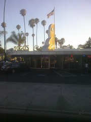
confuse me. Well we’re in Mountain View now. ✓Togo’s. ✓McD. ✓Blockbuster. This is the bland commercial strip I know and love. Danish Concepts.
Those front parking lots just break up any rhythm and character.
5:57 PM from Mountain View, CA
Sun on my window makes it hard to see. I’m worried I haven’t seen many bells. Hoo boy, heavy traffic around Castro.
6:01 PM from Mountain View, CA
Frankie Johnnie & Luigi Too. Some fine meals there. Clarkes. Love their hot link sandwiches. ✓Subway. Stevens Creek Trail Entrance.
6:05 PM from Mountain View, CA
✓Gas. Blue street sign, El Camino Real W. ✓In & Out. ✓Gas. ✓Gas. ✓Burger King. De Anza marker. Stevens Creek. CA 85. ✓Bell! The Americana apts.
6:08 PM from Mountain View, CA
Wow that was a long stretch between bells. ✓Lucky. City of Sunnyvale.
6:10 PM from Mountain View, CA
Switched to my last Energi To Go battery pack. Come on little Pre. You can do it! ✓Gas. Sunnyvale Auto Row. Shalimar.
6:11 PM from Sunnyvale West, Sunnyvale
Sign says W El Camino Real. Was that earlier sign premature? I was thinking of getting off at Mission Santa Clara but I think I’ll skip it.
6:14 PM from Sunnyvale West, Sunnyvale
✓Subway. Hiphugger. Where Debi Lyn’s Closet used to be. Adamson’s French Dip. Interesting. Lot of car washes. P.F. Chang.
Fast Food French Dip. I am intrigued.
6:16 PM from Sunnyvale West, Sunnyvale
C. J. Olson. Cherry Orchard Apartments. ✓Safeway. Is this shopping center new? Next to Toys R Us? ✓Bell.
6:18 PM from Heritage District, Sunnyvale
Signs now say E El Camino Real. The new shopping strip had a huge knife & fork sculpture. Pretty garish. ✓McD. ✓In & Out.
6:20 PM from Sunnyvale, CA
Sunnyvale Community Center (I spied the fountain. That counts.) More garish primary color sculptures by Best Buy & Pet Smart.
6:22 PM from Ponderosa Park, Sunnyvale
@DanHugo says the Pet Smart one is Snoopy. Crazy Buffet. Never ate there never will. The name scares me. Triangle Park. No banners today.
Dan tweeted back: “yes, allegedly snoopy. I got ill eating at crazy buffet, ymmv.”
6:24 PM from California, US
✓Bell in the park. Lovely Sweets and Snacks. Sounds delightful. El Camino Plaza. Bell Plaza. Sweet. ✓Subway.
More strip malls with homage names. I approve.
6:26 PM from Ponderosa Park, Sunnyvale
Scary pedestrian crosswalk in front of HanKook. Lady is crossing. Braver than I am. Happily cars stopped for her.
6:28 PM from Ponderosa Park, Sunnyvale
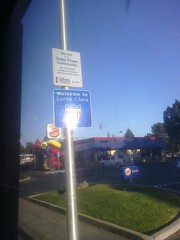
✓Burger King. Myung Dong Grill. Welcome to Santa Clara. All America City 2001. Really? I thought it was the Mission City. ✓Gas. ✓Taco Bell.
Oh I see, Santa Clara won an All-America City Award in 2001, hence the sign. Pretty cool. I thought maybe they had changed their nickname.
6:31 PM from Santa Clara, CA
Lawrence Expressway. ✓Bell. Tofu [Choi’s Kitchen]. Used to be Shilpa. Feh. I miss Shilpa. Korean stretch. Billboard for HP Pavilion looks out of place.
The businesses on El Camino in this part of Santa Clara are predominately Korean.
6:35 PM from Santa Clara, CA
Not many billboards on ECR I think. Buttitta Plaza. Snicker… Vesuvio Pizzeria. AMF Moonlite Lanes.
6:40 PM from Santa Clara, CA
Camino Tomas Center. Name doesn’t do anything for me. ✓Gas. Street signs say El Camino Real. Mervyns Plaza. Spirit is back! ✓Subway.
I see what they were doing with the strip mall name, a mashup of “El Camino” and “San Tomas,” but it falls flat.
6:42 PM from Santa Clara, CA
✓McD. ✓Taco Bell. ✓Bell. Geof Goodfellow Sesquicentennial Park. At least I think that’s what it said. It was a lot to read.
This park commemorates the Battle of Santa Clara in the Mexican-American war. It was rededicated in 2006 to honor a long-time civil servant.
6:46 PM from Santa Clara, CA
Dude has a rockin’ mullet. I mean, that’s just pretty. Fiorillo’s. “The Maze” (101, De La Cruz, etc.)
A guy on the bus had the mullet, not Geof Goodfellow. “The Maze” is what I call the confusing jumble of overpasses and cloverleafs at El Camino, De La Cruz, and Coleman.
6:49 PM from Santa Clara, CA
Turning into Santa Clara Caltrain Station. Santa Clara University. No mission for me today. Stadium. Training center. Practice field.
6:51 PM from Santa Clara, CA
Wrap This. Smoke This. The Alameda. San Jose city limit. Bill’s Cafe. I-880. No more El Camino Real today.
It’s The Alameda, Santa Clara Street, and First Street from now on.
6:53 PM from Rose Garden, San Jose
Center for Spiritual Enlightenment. YMCA. Sign for Egyptian Museum. Planned Parenthood. ✓Bell. Hester Park gates. ✓Gas.
6:54 PM from Sunol-Midtown, San Jose
Tee Nee Thai. Calvin’s. Westminster Presbyterian. Rosie’s New York Pizza. Guess I spend a lot of time here.
6:59 PM from Sunol-Midtown, San Jose
Hanchett Park ✓Togos etc. Billboard. The Usuals. Crema. Billy DeFrank LGBT Center. Babe’s Mufflers. Plant 51. Train underpass.
7:03 PM from San Jose, CA
Los Gatos Creek. San Jose Water Company. Guadalupe River. On West Santa Clara Street now. First Street, and I’m off.
That was my trip! But it wasn’t the end of my day. Read on to see what I did for the next few hours.
10:11 PM
Normally I would have caught the VTA 66 from downtown all the way back home but tonight was @artwalksj so I decided to check it out.
10:13 PM
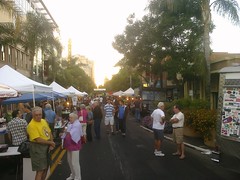
@artwalksj is on South 1st St. which is part of El Camino, extending up from Monterey Road. OMG, I had no idea it was so amazing.
10:17 PM
Too much to tweet, but shout outs to @artwalksj @shoptheusuals @streetbot @treatbot (recuperating) @mogobbq (dinner) @quickdog @mrjoenance
10:18 PM
Walked the walk, but messed around and ended up missing the VTA 66 by like 1 minute. Hour wait until next one. Dang.
Remember how I just caught the VTA 66 by 1 minute at the start of the day? Payback’s a bit of an inconvenience.
10:22 PM
Plan B: hopped light rail. Will be rescued by my lovely wife from Great Mall. Thanks P! She had her own @mogobbq adventure tonight I hear.
She and my son generously came and picked me up from the Great Mall despite the late hour. Mogo has two trucks, you see, and our family managed to eat at both of them that night.
10:25 PM
What a day. BTW I drained my last Energi To Go at Artwalk taking pictures, so I’m plugged into my laptop as last resort.
10:26 PM
Almost to Great Mall. Will clean this up and post to blog. For now, signing off. Thanks for making the trip with me!
That’s it. I did it. I rode El Camino Real from San Jose to San Francisco and back to San Jose. And boy are my thumbs tired.