Do you know what’s embarrassing? Getting lost on El Camino Real. I don’t mean “lost” in the poetic sense, as in getting so enraptured by the sights and wonders that I lose all sense of time. I mean “lost” as in not having a perfectly clear notion of either where I am, where my destination is, or the precise relationship between the two. “How could you possibly get lost on El Camino?” you protest. “It’s a street, a one-dimensional line!” This is true, but after 200 years the road has developed a few idiosyncrasies which can snare the unwitting traveler. One of them is the city of Los Altos.
Border Road
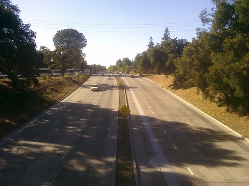
The first tricky thing about Los Altos is something that residents know but it took me a while to figure out: Los Altos does not cross El Camino Real. The city flows down from the hills but in its northernmost section it abuts El Camino. That means if you’re driving down El Camino, Los Altos exists only on one side of the street. El Camino borders Los Altos for about a mile and a half.
This is unusual. As far as I can determine, there’s only one other city in the Bay Area that touches but does not cross El Camino: Hillsborough, and that’s only for about two blocks.
Tri-City Area
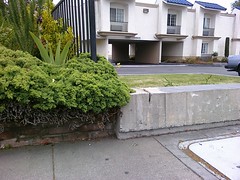 Los Altos doesn’t exist in a vacuum. For that mile and a half stretch of El Camino, the other side of the street is either Palo Alto or Mountain View. There is a spot on El Camino between Del Medio and Los Altos avenues where Los Altos, Palo Alto, and Mountain View all meet in a single point. No wonder it’s easy to lose track of where you are! The border between Mountain View and Palo Alto is marked only by the fence, bush, and break in the low wall in this photograph. Really they are the property line between the Country Inn Motel (Palo Alto) and The Hotel Aria (Mountain View), which used to be a Holiday Inn. Cryptically there is a signpost right here pointing to Los Altos (Avenue, that is) which takes on new significance.
Numbers Game
Granted, maybe it doesn’t really matter to you what city you’re in unless you’re challenging the jurisdiction of the speeding ticket you just received from the other city’s Police Department. What really matters is the street address right? Well that’s where things get really crazy. Take a trip with me.
Say you’re on El Camino in Palo Alto, heading south. As you cross Arastradero Road you’re on the 4200 block of El Camino with even addresses on your right and odd addresses on your left. The addresses increase as you go. As we all know, one of the cornerstones of modern civilization is that even and odd addresses are on opposite sides of the street, and that street addresses are ordered monotonically. You pass the Crowne Plaza Cabaña Hotel at 4290 ECR which is the last Palo Alto address on that side. You cross Adobe Creek and your side of the street is now Los Altos, though the other side of El Camino is still Palo Alto. Still with me? Fear not because the addresses still make sense. Both sides are now the 4300 block; the Motel 6 Palo Alto on your left is 4301 and the Courtyard Los Altos on your right is 4320. (There are a lot of hotels here.) You roll on and cross Los Altos Avenue. You’re still in Los Altos on your side but as we said, soon the other side turns into Mountain View. Your side is the 4400 block but the other side, the Mountain View side, is suddenly 2700! What?! That’s right, the addresses take a quantum leap on that Palo Alto/Mountain View side of the street.
Remember that the border between Palo Alto and Mountain View lies between the Country Inn Motel and The Hotel Aria. They are neighbors, but here are their addresses:
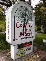

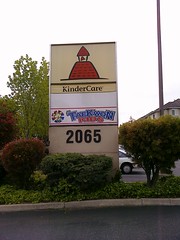
4345 El Camino in Palo Alto, 2700 El Camino in Mountain View, literally next door to each other. Not only do the numbers jump, but the Palo Alto addresses are odd and the Mountain View addresses are now even. The Los Altos addresses on your side are also even. This is madness! But wait, there’s more. As you keep driving, your Los Altos addresses continue to increase, but your Mountain View addresses get smaller! They run in opposite directions. You get to the end of Los Altos and cross over into all-Mountain View a little past Rengstorff Ave. On your side the last Los Altos address is 5150 El Camino Real and their neighbor in Mountain View is 2065. Even addresses become odd. The 5100s become 2000s. Enough said.
This address nonsense used to trip me up from time to time. Back in the old days before online maps and GPS units, I would look up a business in the phone book (remember those?). Maybe I was going to El Torito at 4470 El Camino Real, Los Altos. (Don’t bother looking for it now; it’s gone.) If I made the mistake of approaching through Mountain View, the addresses around me would be no help at allsomewhere in the 2000s when I’m looking for 4470, and odd when I’m looking for even. This confusion is part of the reason I started AllCamino.com. I felt a need to understand these addresses and help my fellow sufferers. Don’t even get me started on West El Camino, East El Camino, South El Camino, and North El Camino.
Reading Signs
It’s not all bad. Even without wireless navigation technology there are plenty of hints to keep you oriented. There are well-placed “city limits” signs, and the light posts have handy civic banners hanging from them. Los Altos Patch Editor L.A. Chung pointed out a useful trick. Los Altos city street signs are brown and Mountain View signs are blue. I figured out on my own that Palo Alto signs are white, but the Palo Alto trash cans are blue.
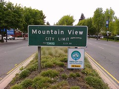
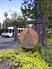

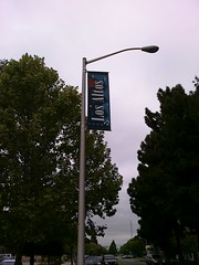

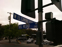
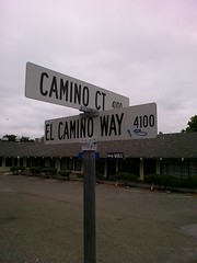
I still get lost on El Camino every now and then which is especially humiliating since I have this blog and all. Technology helps but I can’t always rely on it, so I’m learning that a little knowledge and good ol’ powers of observation go a long way. And if those fail me there’s always the last option of a desperate man: stopping to ask for directions.

