
The Palo Alto Caltrain station was the county-nental divide for my transit trip up El Camino Real. It’s where I left the VTA system which serves Santa Clara County, and boarded the SamTrans Route 390 bus which serves San Mateo County. I had a few minutes to wait so I spent them studying the posted maps and schedules. That’s when I spotted a notice that was as welcome as it was unexpected: select VTA and SamTrans routes accept each others’ day passes in Palo Alto. I could use my VTA pass to board the SamTrans 390! For free! Sweet!
Time : 1:50 PM
Place: Palo Alto Caltrain Station
Route: SamTrans 390 to Daly City BART
Fare: $0.00 w/VTA day pass!
Total: $6.00
The 390 arrived after a few short minutes. It was an impressive articulated coach. I boarded and flashed my VTA pass with just a hint of nervousness that it would be rejected, but my papers were indeed in order so I had no problem at all. The train station is the startpoint for this route so the bus was empty. I had my choice of seats and selected one on the right side as I planned, stowed my backpack at my feet, and settled in for the long ride up the Peninsula.
I’ve lived in Santa Clara county for a while now and I like to think I brim with civic pride, but I have to say honestly that the SamTrans 390 was nice. Really nice. Frankly it blew the VTA 522 off the road, which pains me to admit. The windows were clear (no wrap!), the seats were comfy, and the air conditioning was luxurious. Best of all its general pace was much more leisurely. As we pulled out of the station past the historical marker at MacArthur Park and turned onto El Camino, I could literally feel myself relax as I sat back and prepared to enjoy the ride.
I hate to bag on VTA but I’ve always been ambivalent towards it. There was a period when I took it every day to work and regularly took it to special events downtown. It’s an adequate system, but I wish I could say it’s great. The fact is it’s troubled with low ridership, high fares, and increasingly infrequent schedules. Part of the problem is that the county, especially San Jose, is so gosh-darned spread out with relatively little population concentration that it’s tough to service it efficiently. Plus in our history we’ve been blessed with some boom times, most recently around the high tech industry, that resulted in a solid suburban middle class and drove the adoption of a car culture. So our buses are not world-class. I do have hope for the future of VTA given new high-density development around transit hubs and the plans I’ve seen for dedicated-lane Bus Rapid Transit, but we’re not there yet.
Back to SamTrans, I noted with approval the aptly named El Camino Park as we drove by, then tried and failed to spot El Palo Alto the landmark tree as we crossed San Francisquito Creek; I think it’s just not visible from El Camino. And then just that quickly we left Palo Alto, left Santa Clara County, crossed into San Mateo County, entering Menlo Park.
The Tesla Motors dealership is a hopeful spark in contrast to the three or four closed car dealerships just up the street. There are still plenty of gas stations though, additional reminders of El Camino’s car-serving nature. Jeffrey’s Hamburgers stands out as an eye-catching diner; I’ll have to check it out soon but it will be competing with some of my favorite burger joints past and present on El Camino. At Ravenswood I saw the first historical bell of the county and it was a standout because it’s the first I’ve seen that isn’t hanging from a trademark shepherd’s crook guidepost. Rather it’s hanging on a yoke which I presume is how they were mounted in the actual missions.

I took pictures of this bell, and these were pretty much the only photos I managed to take out the bus windows all day. The only reason I got these is that I lucked out and the bus was stopped at a lengthy red light. I had planned to take many more, but I was overwhelmed simply trying to look vigilantly out the windows without missing anything. It was hard enough just taking notes; photos were beyond me.
The light finally turned green and I was treated to the ultra-hip Menlo Center and the sublime Kepler’s Books. I noted a historical marker at Triangle Redwood Grove, and that Gaylord Indian Restaurant had closed. Gaylord at the Stanford Shopping Center used to be a favorite with my family and my college roommate. I still miss it.
Soon the businesses went away and El Camino became all trees, fences, walls, and the backsides of really expensive homes. Welcome to Atherton. Many of these houses back right up to El Camino, but I presume none of them has an El Camino address. When the neighborhoods cleared and we got to the business district it felt very close with two-story buildings butting directly against the sidewalk, like a tall narrow corridor. There’s a distinct village feel, but severe and a little creepy, like the kind of place you read about in pulpy horror stories. Pleasantville by day but at night, no one will hear your screams…
Atherton is wide but short so before I knew it we rolled into Redwood City. I jotted something about “SF Water Dept.” but have no idea what that was a reference to. I may have become distracted because around this time the air conditioning on the bus shut off and the heat snapped on, throwing me for a loop. We passed the Target at Charter Street then the SR 84 junction, our first highway crossing in quite a while. Harry’s Hofbrau made me nostalgic with its old-timey decor. There’s an El Camino bell posted nearby at Chestnut Street, welcoming you to town. Franklin Street Apartments provide some residential density convenient to the shops and transit at bustling Sequoia Station, but Maguire Correctional Facility looms soberly behind it. A quick look down Broadway reveals a classic and historic downtown (“Climate Best by Government Test”). The Ben Frank’s hot dog stand is as iconic and appetizing as ever, but it overlooks the too-close at-grade Caltrain crossing which was the scene of a shocking tragedy last year. I chuckled at the odd alternating type sizes on an “EL CAMINO REAL” street sign, then noted with satisfaction that the Caltrain tracks are at a higher, safer grade by the time it crosses over Howard Ave. This stretch has some big culverts which are cool to look at. Somewhere along the line I noticed a couple free newspaper boxes for the Daily Post and Daily News.
As we cruised into San Carlos I stuck dogmatically to my strategy of only observing the right side of the street. That’s when I discovered that in San Carlos, there is no right side of the street, just gravel lots and train tracks. The Caltrain tracks are so close to the road there’s no room for proper businesses so most of it is left open. The businesses that should be there seem to be on the other side of the tracks, on Old County Road. The San Carlos Caltrain depot at San Carlos Avenue however is an eye-catching exception, and is graced with a bell. Things open up shortly and there’s a posted notice for proposed development north of the station, which is a recurrent theme. San Carlos Plaza, a shopping center, leaves no doubt that the right side of El Camino is indeed open for business. Trivia break: this paragraph contains the name “San Carlos” seven times. San Carlos.
Belmont is frankly more of the same. There’s a bell near Harbor Blvd. and another at the Belmont Caltrain station at Ralston Ave. By then the right side narrows to a gravel lot again. Then something surprising happens: El Camino must gain a little elevation because the sight lines clear and you gain an expansive view of the San Mateo Bridge and the East Bay hills. Google Street View tells me this occurs around Marine View Street and Mountain View Avenue. Someone was paying attention when they named those streets.
Now entering San Mateo, the county namesake. I had assumed it is the largest and most populous city in the county, but sadly it is neither. However we started to hit the first heavy traffic of the day around SR 92 so clearly it’s big and populous enough. The first thing I wrote down is there are no sidewalks at 42nd Avenue. Yumi Yogurt was a happy sight at 38th Avenue but it has no sidewalk either. I noted Hillsdale Shopping Center even though it’s on the other side of the street; an unforgivable mental lapse. However I was back on track with Ana Furniture which stands on the correct side of the street, across from the mall. Peninsula Station is a mixed-use development appealingly sandwiched between El Camino and Caltrain. This section has a kind of retro downtown feel with small sidewalks culminating with the highrise Tower Plaza building. There was a line out the door at Heidi’s Pies, people no doubt picking up orders for Turkey Day desserts. There was no rush though because Heidi’s never closes. Ever. Bridge Point Academy was the first school I had seen in a while, and The Beading Frenzy wins for the best business name of the day. My wife and my mom have both been into beading; the imagery in the name describes the ensuing mania perfectly. Scenic Central Park is bounded by 5th Avenuea sly homage to Manhattan geographyand is the gateway to downtown San Mateo. There’s a multi-level parking garage at 2nd Street which is great since downtown is so strollable.
One notices that there are a lot of churches on El Camino in northern San Mateo. The Church of St. Matthew and St. Matthew’s Episcopal Day School occupy beautiful grounds near St. Matthews Avenue. Notably up to this point in San Mateo the street signs say “S El Camino Real” but here they switch to “N El Camino Real.” Indeed the address of the church is One South El Camino Real and this is where the numbered cross streets begin, starting with 1st Avenue and continuing into the forties as you proceed south. San Francisco and Santa Clara of course were Spanish Catholic missions that became cities and counties. San Mateo separates them but there was never a mission here, rather a satellite Franciscan outpost where San Mateo Creekwhence the region got its namecrossed the Royal Road. It’s notable then that here at the equator of the city, where north becomes south, on the El Camino virtual meridian there is no Catholic chapel but rather an Episcopal church. The Episcopal “big-C” Church as an institution was founded during the American Revolution to replace the Church of England in the newly independent nation. So in a sense the Episcopal Church of St. Matthew, built in 1865 on the site of the abandoned mission outpost, represents the region’s Americanness, a Yankee stake in the Ohlone-then-Spanish-then-Mexican ground, the footprint where Mateo got kicked out and Matthew was shoed in. Fittingly here at the crux of San Mateo’s history and culture is placed an El Camino bell marking the spot where a mission might have been.
My parents live in San Mateo, a short stroll from El Camino. As it turned out, it took nearly three hours to get to their house from mine by bus, an amusing family factoid. I’m tempted to laugh at how impractical this mode of transportation seems, but in fact there was a passenger who got on the 522 with me in San Jose, transferred to the 390, and got off in San Mateo. People do it. As I was pondering this we entered Burlingame and were reminded by a familiar historical marker that Juan Bautista de Anza had been there 230 years prior. A public parking lot at Burlingame Avenue is convenient for shoppers and diners. Near Floribunda Avenue I spied a bell and not much further the wonderful onion domes of the Church of All Russian Saints. Russians have a long history in California, but that’s a topic for another time. Crossing Broadway downtown gave me a sense of déjà vu, having crossed Broadway in Redwood City already. There seems to be nothing but churches and apartments here, and I was struck how there were no pedestrians. After the businesses and apartment buildings faded we entered another zone of backside fences shielding single-family dwellings, similar to Atherton. The difference here though is the corps of venerable landmark eucalyptus trees. A bell at Rosedale and Peninsula Medical Center at Trousdale were my final Burlingame observations.
In my life I’ve been to San Mateo too many times to count and to Burlingame maybe a dozen or two, but north of there San Mateo County is the wild unknown to me. Some of those cities I’ve been to a handful of times and others not at all to speak of, particularly not their El Camino profiles. It was actually kind of wonderful finally to experience these cities which are household names but which I had only visited in Google Maps excursions. Let me tell you, when you start a blog about a street, you wind up spending a lot of time in Google Maps. A lot. This in a nutshell is why I undertook this trip. There’s no substitute for being there.
At Millbrae Avenue this bus turned off of El Camino for the first time to stop at the spectacular intermodal bus-BART-Caltrain Millbrae station. That’s when I realized how close El Camino is to US 101 here, probably the closest I came all day. By now it was after 3:15PM so school kids started boarding the bus, happy and chatty, ready for their long holiday weekend. Their presence brought a lively if slightly rowdy change of atmosphere. Back on El Camino, on the 1000 block there’s a bell. A little further a tree in front of the Mission revival Best Western El Rancho bears some kind of historical marker, but I don’t know what it signifies.
 San Bruno gets a standing ovation: their street signs sport their city seal which contains not one but two bells. Bravo! Now that’s some El Camino pride. In reality much of El Camino here is a commercial hodgepodge. It is happily broken up at “The Avenue” A.K.A. San Mateo Avenue, San Bruno’s deliberately-branded downtown shopping district. There is an actual bell here, presumably the model for the seal. I wonder though how those traditional downtown storefronts fare in the shadow of The Shops at Tanforan and San Bruno Towne Center. Malls kill commercial strips; that’s the perennial challenge for city planners. So is traffic, which again got heavy as we approached I-380. I don’t think I’ve ever been to Tanforan, and I was until now unaware that there’s a Hooters there, right on El Camino. Look for more in a future post. I will of course be looking for signs of improved morale and career advancement opportunities after their CEO’s epiphany on “Undercover Boss.” Plus I want to see the barstool trick.
This is where I became aware of San Bruno Mountain rising before us. Ironically it is actually in South San Francisco, “The Industrial City.” The mountain really anchors and defines South City. There’s something else in South San Francisco: the headquarters of See’s Candies. I love candy and I love chocolate; I wonder if they give tours? After a while I noticed the road starting to ascend, and sure enough by the time we got to W. Orange Avenue we had gained a bit of altitude as we started to cross the northern tip of the Santa Cruz Mountains. I saw some big honking crows here. Kaiser Permanente Hospital looms large and Park Station condos and Archstone Apartments cozy up to the South San Francisco BART station, which again we had to turn off of El Camino to get to. The bus passed a Costco I had actually stumbled upon once years ago while looking for gas, and nearby there’s a bell. Treasure Island RV Park has a playful name. Here’s something to ponder. San Francisco and South San Francisco are in different counties, as are Palo Alto and East Palo Alto. Fascinating.
Something else that’s fascinating is the city of Colma, “City of Souls.” To make a long story short, in 1900 it became illegal to be dead in San Francisco so Colma grew as a city of cemetaries to hold the San Francisco deceased. As you roll through Colma it’s literally cemetary after cemetary after cemetary. King of them all, at least from a bus on El Camino, is Cypress Lawn. Holy Sepulchre, Batman, is it ever gorgeous with manicured lawns, serene landscaping, and elegant structures. A nice place to visit. People do actually live in Colma, as evidenced by their landmark police station, and it has a homey village feel. Colma does have a bell, right in front of Eternal Home. Bill Graham is buried there. Here though there are graves just feet away from El Camino which was somehow a bit shocking, but a frank reminder that not every final resting place is a country club. I made a note of pedestrians at the walkway to D street; it could be they were the first people I saw in town. Sidebar: the Colma Historical Association claims that “Colma” is an Ohlone word meaning “many springs” but I don’t buy it. I’m convinced it’s an acronym for “City Of” something, but I don’t know what yet. “Lawn-Mowed Acres”? “Little Motion Anywhere”? “Last Mortal Address”? What do you think?
I noticed the street signs changed to some cool-looking blue ones with a bird logo and indeed the street name itself changed to Mission Street which means we were finally in Daly City. Mission Plaza at Citrus Avenue is a large retail center and there’s a bell in front. The War Memorial Community Center and John Daly Library complex are newly remodeled civic jewels and Landmark Plaza are condos in progress. My main impression was how similar Daly City is to San Francisco, dense and hilly. A spectacular view of Sutro Tower, not to mention some distinctly urban traffic, underscored this notion. Then at long last we reached the storied top-of-the-hill in Daly City, which I was very satisfied to see has a bell planted firmly at its peak in a place of honor. I’ll go out on a limb and claim without substantiation that this is the highest-altitude and westernmost bell in the Bay Area.
The bus turned off Mission onto Hillside to head down to the Daly City BART station, the end of the line. It was about 4:00 PM. I gathered my things, disembarked, and prepared to board Muni for the final push into San Francisco.
Next installment…Do You Know the Way to…?

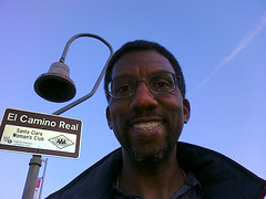 Do you like my profile photo there? It took me many takes and half an hour to get it right. It’s a trick-shot self-portrait and all I had as a guide was the little mirror on the back of my cameraphone. It was a lot harder than I expected and I got some funny looks from drivers whizzing by on El Camino. Can you locate that bell?
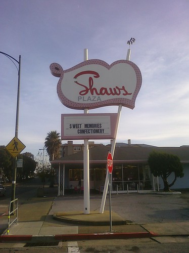





 San Bruno gets a standing ovation: their street signs sport their city seal which contains not one but two bells. Bravo! Now that’s some El Camino pride. In reality much of El Camino here is a commercial hodgepodge. It is happily broken up at “The Avenue” A.K.A. San Mateo Avenue, San Bruno’s deliberately-branded downtown shopping district. There is an actual bell here, presumably the model for the seal. I wonder though how those traditional downtown storefronts fare in the shadow of