Archive for the ‘San Jose’ Category

Rubber on the Road

Sunday, July 18th, 2010

IMG_9629bRedemption! Back in April I heard that San Jose Bike Party was rolling down El Camino Real through Mountain View and Sunnyvale so I jumped in my car to check it out and failed! Thousands of bicyclists, hooting and hollering, cruising down a five mile stretch of the most important road ever (IMHO), and I missed it. I read the route map carelessly so they looped right around me. Sad. But Friday night July 16, 2010 I had a second chance. Bike Party chose The Alameda for its monthly appearance and this time I…was…there!

My wife alerted me about it a couple days ago. She follows Treatbot, the Karaoke Ice Cream Truck (more on that later), on Facebook and they announced they would be at Bike Party. I looked up the route Friday morning and was happy to learn they were starting at Santa Clara University and riding down El Camino Real and The Alameda to Naglee Avenue, from there going to the city of Saratoga and looping back around to Santa Clara. After work I ran home, grabbed my camera, and drove down to The Alameda. I strategized on-the-way. I knew if I took the The Alameda exit off I-880 I would risk getting caught up among the bikes and that’s a bad place to be. Instead I got off one exit earlier at Coleman and took surface streets to The Alameda and Taylor so I would never have to cross the stream in my car. I needn’t have worried; I got there before the bikes.

I only had a few minutes to wait before they started showing up. It began with a few riders arriving from all directions to meet up with the main pack. Then it came. I can’t think of a metaphor which will do it justice without being trite so I’ll use the shotgun method. A river. A flood. A chain-driven stampede, a teeming mass, a peloton of everymen. Over three thousand bicycles pouring down the Alameda, turning right on Naglee. Short bikes, tall bikes, custom bikes, normal bikes. Bikes with bells, horns, and stereos blasting tunes. One rider had a vuvuzela. Those without noisemakers gleefully shouted, “Bike party!” Woo! There were bikers in street clothes, casual clothes, um…bicycle clothes, and costumes. The theme was “Deity Ride” since the ride started at a Jesuit university and passed many churches and spiritual institutions along the way so several riders dressed as Roman gods in togas, Viking gods in horned helmets, and Earth goddesses with garlands. Special mention of the night goes to the guy riding his bicycle while playing bagpipes. I saw bikes. I saw a party.

I took a bunch of photos. If you want to see them, take a look here.

I’ll be the first to admit they aren’t very good. The light was fading and the subjects were moving so I cranked the ISO and hoped for the best. I got a bunch of what I call “I was there” shots. Hardly art, but they tell the story. If you want to see some really outstanding photos, photographer Richard Masoner shared some great ones at www.cyclelicio.us. Find them here or see the whole set at Flickr. He snapped a pretty good one of bagpipe guy!

After about half an hour on The Alameda, I crossed the street on foot with some difficulty and hopped in my car and drove up to El Camino upstream as the bikes were still flowing down. In Santa Clara some spectators (not riders) shot off some fancy illegal low-flying rockets left over from the Fourth of July right in front of me; surreal. I got all the way up to Santa Clara University where the ride started. By then all the bikes had passed me by, so I can say I saw the whole thing in about 45 minutes.

I enjoyed watching the riders, soaking in the festive atmosphere, waving back as they passed me by. Reading the comments on their blog though there were a couple edgy incidents. First, some riders in spots were guilty of taking up all lanes of the road, not sharing with cars. I saw this myself. I also saw some riding against traffic and red light running. This kind of riding is against Bike Party’s policy, and it was heartening to see them policing themselves to maintain good will with the community.

Requiescat in Pace: Father Paul Locatelli, S.J., 1938-2010The other incident was a case of unfortunate timing. Father Paul Locatelli, former chancellor and president of Santa Clara University, died on Monday, July 12, from pancreatic cancer. The university held an outdoor funeral Mass for him Friday on campus, at the same time the Bike Party commenced. I gather the festive and boisterous atmosphere of Bike Party regrettably interfered with the more solemn event. Mortifyingly, some truckers honked their airhorns in support of Bike Party as it rode past, probably unaware of the funeral nearby which was disrupted by the noise. I don’t know Fr. Locatelli but I’d like to think any university president would smile at the youthful exuberance of the riders; still that’s little comfort to the mourners who came to pay their respects to him that evening and had their ceremony disrupted.

All-in-all Bike Party is an undeniably happy thing. It’s wonderful to see San Joseans come together in good humor and solidarity and explore our magical valley and get a little exercise to boot. As subcultures go this one is accessible and enticing. Maybe one night I’ll join them. That’s if I don’t read the map wrong.

Granted

Friday, July 16th, 2010

CIMG0163
W00t! The Mercury News reports that the San Jose Department of Transportation has been awarded a $3.1 million dollar grant from the Metropolitan Transportation Commission to work on improving The Alameda! The city will begin implementing The Alameda: A Plan for “The Beautiful Way” which was developed in the series of community meetings which my friend Elena and I enjoyed participating in over the past year.

Work will begin on Phase One of the plan which calls for widening sidewalks, planting a raised median, creating safer pedestrian access, and generally beautifying and unifying the character of the “Town Center,” the southern stretch of mostly commercial buildings from Fremont Street down to the train  tracks. The goal is to enhance The Alameda’s appeal as a hip, strollable destination that showcases San Jose’s charm and history.

CIMG0164Elena and I go way back to her freshman orientation at Stanford my senior year. She recently moved to San Jose and quickly came to appreciate The Alameda, especially its casual and fine dining. At the community meetings she offered many thoughtful suggestions such as making it safer for bicyclists, and catering to families with young children the way Lincoln Avenue in Willow Glen has done. Me on the other hand…well my best suggestion was to save the historic El Camino bell marker. Um, that was before I even realized there are three bells on The Alameda, not one. Gold star for trying.

This is exciting news for the community and it will be fun to watch all the planning become a Beautiful reality.

What are your favorite spots on The Alameda? What’s your opinion of controversial features like the Hester Avenue pedestrian underpass, Babe the giant muffler guy, and the Race Street billboard? Should they stay or should they go? Have you ever crossed The Alameda on foot at any of the crosswalks without traffic lights, or does your life insurance policy prohibit it?
CIMG0166b

Fourth Photos

Saturday, July 10th, 2010

I took a bunch of photos on the Fourth of July at the Rose, White, & Blue parade and at History Park. Enjoy!

IMG_9459

Rose, White, and Blue in the Face

Monday, July 5th, 2010

CIMG0054Every year I think I’ve written new Fourth of July traditions in stone. I let myself believe I’ve got the celebration dialed in, and that’s the way I’ll be observing it from then on. And every year I’m wrong. Something changes that causes a little tweak or a giant upheaval. Sometimes it’s an improvement, and sometimes it’s a back-to-the-drawing-board experience. For years though the cornerstone of our July 4 festivities was the America Festival at Downtown San Jose’s Discovery Meadow. Sadly in 2009 that mighty event fell victim to the deflated economy and had to be canceled. To console ourselves on the Fourth our family went to Calvin’s on The Alameda for cheese steaks and discovered quite by accident the Rose, White, and Blue Parade. We missed the morning parade but the accompanying festival was still on so we perused the booths and shops, and made plans to come back this year.

Fwd:We arrived early this year and found shady spots on the parade route, under the El Camino bell on the west side of The Alameda at Singletary. That was no accident; it’s a special spot for me. I’m generally not a parade person because they’re always too early in the morning (I like to sleep in on holidays; so sue me), but I was in the right mood and this one was delightful. It’s not a huge production with marching bands and animatronic floats. Rather it’s a heartfelt community showcase with neighborhood kids on bikes, girl scout and boy scout troops, vintage car enthusiasts, and elected officials. The geeky highlight was Grand Marshal Steve Wozniak riding an Egyptian barque, surrounded by his Segway polo friends, one of whom was coincidentally an old co-worker of mine from Apple, Bill Knott. The giggliest moment was a lone be-kilted bagpipe player droning out Rod Stewart’s “Da’ Ya’ Think I’m Sexy.” The most sublimely surreal moment was Chuck Reed, the mayor of San Jose, cruising down The Alameda in the back of a straight-up cherry low-rider, bewildering uninitiated onlookers every time it stopped and dropped so low it was scrapin’.

By the time the last of the parade passed by—two ladies on horseback (it was smart to put them last) with a police car chaser—it was lunchtime so we headed once again to Calvin’s. Tradition! I can think of no better tribute to the signing of the Declaration of Independence than Philadelphia’s best cheese steaks. We weren’t alone; the line was out the door. It was an extra long wait but so worth it, and we reveled in our “sandmiches” while an Elvis impersonator cheesed us from the “American Stage.” Then we worked our way down the double row of booths—nearly twice as many as last year—cleverly arranged on the shady western half of The Alameda between Lenzen and Race. Kudos to the prior and current presidents of The Alameda Business Association Larry Clark and Michael Barnaba for spearheading a successful and growing event. My wife was drawn to the vendors of handmade jewelry, but I had a different agenda.

Two agendas, actually. The first was chocolate. Schurra’s had a booth and I bought myself a Rocky Road treat: a giant homemade marshmallow brick topped with almonds and covered in chocolate. The lady asked if I wanted a bag. Ha! I told her that would only slow me down. It was gooey, melty wonderment.

CIMG1233That out of the way, I moved on to my primary objective. This was the third year for the Rose, White, and Blue Parade, but it traces it roots back to a legacy of Rose Festivals in San Jose dating back to 1896. At the 2009 parade I found Shannon Clark’s book, The Alameda: the Beautiful Way, which I acknowledge was the spark that convinced me finally to start this All Camino blog. This year I was delighted to see she had produced a new book in collaboration with her sister Allison called Roses on Parade: a Santa Clara Valley Tradition, an exposition of this very event. I bought the book at their booth, got it signed, and networked with my fellow El Camino history buffs. At least I thought I was a history buff, until I met Bill.

CIMG1232The booth next to the Clark sisters’ was a modest affair, simply a few rows of clotheslines with historic photos of The Alameda clothes-pinned to them, flapping like pennants in the warm breeze. A lone gentleman was narrating them, jovially taking questions and leading listeners from photo to photo to illustrate the timelines he was reciting from memory. His name is Bill Wulf and he’s a 71-year-old San Jose native, railroad enthusiast, Los Gatos expert, and Santa Clara Valley historian extraordinaire. It’s tempting to say he knows everything there is to know about local history and his ready facility with names, dates, and anecdotes would seem to back up that claim, but it would do him a disservice. He impressed upon me that though he has been meticulously and doggedly researching his subject for decades, he’s still learning something new every day and constantly having his understanding challenged and refined. That’s what amazed me. He’s not just a passive font of facts; he’s an active and probing student of stories, and a really nice guy no less. He’s the kind of historian I can only aspire to be.

I honestly have no idea how long I stood there talking to him, he was so generous with his time and information. I think it was a couple hours. I lost track of time and shamefully neglected my wife (she bought some jewelry in mock revenge), but I learned a ton of great things, like how Mrs. A.S.C. Forbes was inspired by her colorful father-in-low James Alexander Forbes to romanticize California’s Mission past and memorialize El Camino Real with posted bell markers. I learned about troves of primary sources to explore like forgotten county archives and collections of the Franciscan order. I appreciated his theories about practical land routes that were the basis of the real El Camino. And I only scratched the surface. I look forward to meeting him again.

Finally I tore myself away and my wife and I finished strolling the fair and went home. Our day wasn’t done though. You’d think we would have both had enough history for one day by then, but you underestimate our capacity. We grabbed a couple sandwiches from the Togo’s at Oakland Road and Brokaw and headed down to History Park in San Jose’s Kelley Park for the History San Jose Fourth of July Celebration. Can I possibly use the words “history” and “San Jose” any more in a single sentence?

If you had trouble parsing that sentence, it will help to know that “History San Jose” is the name of San Jose’s historical association. They host an annual members-only (yeah, I’m a member) Independence Day event at their showpiece village in Kelley Park, a collection of reconstructed or physically relocated buildings and landmarks from San Jose’s past. Kelley Park isn’t quite on El Camino Real (it’s three long blocks from Monterey Road) but its centerpiece is a half-scale replica of the famous electric light tower which once straddled the intersection of First and Santa Clara Streets downtown, so it represents. We rode the electric trolley and strolled the grounds and chatted with Judy—a long-time HSJ volunteer we met—and her family and friends until it was dark enough to enjoy the San Jose Giants’ fireworks display happening across the street at Municipal Stadium and the unsanctioned fireworks outbursts happening everywhere else.

That was our Fourth, dipped in San Jose and fried in history. It may seem odd to focus on a seemingly academic subject on this defining day of summer but when you think about it, it’s not so weird. The Independence Day celebration is plainly and simply a celebration of American history, a way to bring it percussively to life. San Jose was dubiously Spain during the Revolutionary War but we’re America now. If there’s one date an American schoolchild needs to remember from history lessons, it’s July 4, 1776. It just so happens that some people know a few more dates than that.

Railroaded

Wednesday, June 16th, 2010


View San Jose robbery and police chase in a larger map

The Milpitas Post reports that an alleged robbery and car theft that started on Sierra Road (that’s Sierra, not Serra!) in San Jose led to a police chase that ended when the suspect was apprehended at the dead-end at Railroad Court, at the northern end of Main Street in Milpitas. That happens to be where the Milpitas Post is located, so you could say the scoop landed on their doorstep. This funny little intersection is where Main Street crosses the railroad tracks, near Judge Weller‘s dairy farm. It used to connect with Milpitas Blvd and continue on to Mission San Jose and other East Bay destinations, but it was cul-de-sac’ed decades ago. If the suspect had been an avid consumer of arcane El Camino Real knowledge like myself he surely would have known this and not snared himself in the trap. Or perhaps that was exactly his problem; he was trying to flee to the mission for sanctuary and was following a really really really old map.

ECdSJ_diseno

Hopefully no one was seriously hurt (the police had to use a stun gun), property is rightfully restored, and justice will be served.

[Source: Milpitas Post]

Read Any Good Books Lately?

Sunday, April 25th, 2010

You know those Arcadia Publishing Images of America local history books? I’m talking about the sepia-toned paperbacks about a single city or region, filled with pages of old photographs and local lore. I love them. After I started researching El Camino Real I became slightly addicted to them. I couldn’t go into a bookstore without gravitating towards Arcadia’s distinctive displays and very often walked out with one or two books. I at least had the self-control to limit myself to California cities on El Camino, but more than once I brought home books only to find out I already owned them. Mockery from my wife has prompted me to make a Google bookshelf of all the Arcadia books and other books I’ve accumulated about El Camino Real and California history so far. It will help me prevent duplicates, but beyond that it’s cool to see my whole collection in one virtual place.

I have 33 books in the list as of this posting, but I know I’ll be adding more. I own most of these titles, some I’ve gotten from the library, and the rest I’ve just heard about and hope to read some day. Fact is I’ve only read three of them cover-to-cover; the rest I just thumb through or look at the pictures or use for reference. That’s how I end up with duplicates—it’s hard to remember I have a book when I haven’t read it yet. Here’s a brief overview of a few key books on the list.

San Jose's Historic DowntownI have twelve Arcadia books, all unique. (I returned the duplicates.) The first one I bought was San Jose’s Historic Downtown. I bought it years ago, before All Camino, simply because I live in San Jose and was charmed by the book. I shortly went back and bought Milpitas because I work there.  The rest I picked up after starting the blog. As I said they’re all cities on some branch of El Camino except strictly speaking Alviso, San Jose,  which is so closely interrelated to its El Caminoed neighbors that it is included honorarily. Besides, Alviso, San Jose was written by the same guy who wrote Milpitas, Robert L. Burrill. There are several eligible books in the series still that I don’t have like San Francisco’s Mission District and Colma, not to mention cities outside the Bay Area. I suspect they’ll find their way onto my shelf eventually.

The Alameda: The Beautiful Way is noteworthy because it is the only one whose author I’ve met, and I got it signed. Bay Area native Shannon E. Clarke researched, wrote, and designed it while an undergrad at UCLA and it’s a remarkable achievement, a comprehensive and indispensable historical account of my favorite El Camino stretch. I bought it on the Fourth of July, 2009, at the Rose, White, & Blue Parade and Festival. Shannon was leading bus tours of historic The Alameda and the Rose Garden. I missed the last tour, but she was kind enough to give me a quick virtual tour using one of the book’s maps as a guide. I hadn’t launched the blog yet, but finding this book was the spark that inspired me finally to get it off the ground.

California's El Camino Real and Its Historic BellsCalifornia’s El Camino Real and Its Historic Bells is golden because it’s the only book I have that is explicitly about El Camino as a road, literally telling the story of its route, passability or lack thereof, and commemoration. What it lacks in polish it more than makes up in dedication, and it contains information you can’t find anywhere else. It’s one of the books I’ve read in its entirety. If Junípero Serra is the father of El Camino Real, Mrs. A. S. C. Forbes is the mother—with apologies to Mr. Forbes and the Franciscan order. You’ll have to read the book to learn more about this dynamic woman.

Deep California: Images and Ironies of Cross and Sword on El Camino RealAnother book I’ve mentioned a few times here is Deep California: Images and Ironies of Cross and Sword on El Camino Real.  It’s an unusual work because it espouses the notion of terrapsychology, the idea that the Earth literally has a psychology and that ecological features like land masses, water bodies, and climate are outward expressions of this inner soul. Since (most) humans are from this planet, we are subconsciously attuned to this psychology and play out its archetypical facets through our individual and societal behaviors. If we act contrary to nature, it reacts in kind. It’s a powerful idea, and the book is a fascinating colorful romp through the stories of California, picking out recurring themes from the human realm that reflect deeper root causes of place and pointing out the mistakes of the past so that we may learn from them. This book means a lot to this blog because it validates the approach I’ve taken, that there is a different way to tell the story of El Camino Real: that the road we experience materially may be interpreted symbolically as a path to deeper truths.

Oh, California, 21st Century EditionAs I read Deep California—front-to-back, and it’s big—I realized I knew very little about California history. I didn’t know Portolá from a pueblo or De Anza from adobe. How embarrassing. Every California schoolchild learns state history in the fourth grade (mission projects!) and I remember seeing this stuff in my son’s social studies book when he was in that grade but I don’t remember what I read in mine a generation prior. So I had a brilliant idea: I bought two grade school textbooks, Oh, California and Social Studies: California Edition, both published by Houghton Mifflin.  One of them is used which makes it very special. (Thanks, Kris, wherever you are, for your responsible stewardship, and I promise to provide the same.) They are a gentle introduction to a daunting subject, they represent at a curricular level what the state believes every citizen should know, and they contain plenty of colorful graphs and pictures. I like pictures. I may not be smarter than a fifth grader, but with these books close at hand I at least have a shot at holding my own.

A last few mentions. Historic Spots in California is I believe the California Bible, and Clyde Arbuckle’s History of San Jose is the San Jose Bible. Historical Atlas of California turned me into a mapaholic overnight. The Labors of the Very Brave Knight Esplandián, a romantic novel written around 1500 by Garci Rodríguez de Montalvo of Spain, is the origin of California’s name. It includes an account of Calafía, the fierce black Amazon queen of the then-fictional island California, who wore armor made of gold as she battled the handsome Catholic hero Esplandián in the first bloody Crusade. She was defeated honorably so she subjected herself and her queendom to Christianity. Allegory much?

Each time I crack open one of these wonderful books I learn something new. The story of this great state is rich and enlightening, but impossibly complex. Studying how El Camino Real slices through it all is an effective way to get a clarifying cross section of history. Moreover the more general a book is, the more carefully I have to comb through it to find information specific to the road, and the more rewarding and thrilling is each golden find. I wish for the time and patience to someday read them all. Unless they make a movie first.

Calvin’s Second Anniversary Celebration

Thursday, April 15th, 2010

This is a big weekend for Calvin’s Philly Cheesesteaks on The Alameda in San Jose. They’re celebrating their second anniversary at that location. There will be raffles, entertainment, and new menu items. There’s so much going on, the most difficult thing is deciding which day to go. But wait a minute, who says I have to choose only one…?

Newsflash…Calvin’s is opening a second location at 1699 W San Carlos in San Jose soon! I like to think of San Carlos/Stevens Creek as the Second El Camino of the South Bay.

As it so happens our family was in Philadelphia for one day last week and we stopped at Geno’s Steaks, the South Philly Cheesesteak institution, to give them a try. The sandwich was very good and served up really fast…but Calvin’s is better. Plus Calvin makes a mean hoagie. We’re fortunate to have him in San Jose.

Calvin’s South Philly Cheesesteaks and Hoagies will celebrate our 2nd year anniversary at this location 1411 The Alameda, San Jose, CA 95126.  We would like to invite you to participate with us starting Friday April 16, thru Sunday April 18, 2010.  We will have a weekend filled with Great Food, Entertainment, Free Giveaways, and much more.

Calvin’s South Philly Cheesesteaks & Hoagies
1411 The Alameda
San Jose, CA 95126
408-286-5626

Friday April 16, 2010

11:00 – 4:00

Join us for a special tasting of Dietz & Watson awarding winning Hot Dogs and Deli Meats.
They are a Philadelphia staple and have been around since 1939.  Special Raffle drawing every hour.

8:00 pm
Calvin’s is pleased to host a special Fundraising Event for  “A Cup of Cold Water.”  This is a non-profit organization providing health education to the community.  They teach you what doctors are too busy to explain.  The evening will feature hors d’oeuvres, a raffle with wonderful gifts, entertainment, free ice cream provided by Treatbot, free samples from Calvin’s new menu. Make sure to take a picture with Calvin to remember this special event, photography provided by Definitive Images, and there will be many more surprises throughout the evening.  You don’t want to miss the kick-off to the 2nd year anniversary celebration!  Join us as we give back to the community!

Saturday April 17, 2010

Free Hot Dogs while supplies last!
Free Raffle!
Join us as we introduce new specialty meats by Philadelphia’s own Dietz & Watson.

Chili Cheese Fries $0.99

Sunday April 18, 2010

Introducing BBQ Sundays
Free Raffle!
Entertainment!

El Camino de San Jose

Saturday, April 10th, 2010

One of life’s more mysterious delights is synchronicity, those moments when you experience a startling coincidence that impresses your instinct as having special meaning that may defy logic. I’ve been enjoying several of these “whoa” moments with respect to El Camino Real since I started this project.

Here’s an example. The afternoon of September 25, 2006 I read the landmark article “What Is Web 2.0” by Tim O’Reilly. It had been written a year earlier, but I’ve always been behind in all things web. I read it, I “got” it, and was inspired to create a web site as a way finally to express this ticklish notion I’ve had for a while of celebrating El Camino Real. The name came to me like a thunderbolt: AllCamino.com. Later that evening I was browsing the San Jose Mercury News online and was astonished to read an article published that same day called “Bringing face-lift to historic road” which was all about the Grand Boulevard Initiative of Joint Venture: Silicon Valley Network, a multi-city drive to revamp El Camino into a unique, thriving street for the 21st century. It was fate; it reinforced that El Camino has a story to be told. I registered the domain name immediately.

CIMG0150Here’s another. I registered the domain in 2006 but didn’t get around to creating this blog at the site until August 11, 2009. (I told you I’m always behind.) I accomplished this milestone with my laptop at the San Jose Library Rose Garden branch using their free wi-fi. After creating the blog, to celebrate I drove up Naglee Avenue and down The Alameda to Tee Nee Thai for lunch. On the way I happened to see the Hester Park gates at Singletary Avenue. I had never noticed them before and I wondered what “Hester Park” meant. Was there really a park? Aha, an El Camino mystery to investigate! So after lunch I walked back up to Singletary and took some photos of the gates. I walked down Singletary several blocks to look for a park. I didn’t find one so I turned right on Park Avenue, passed Hoover Middle School and the Egyptian Museum, turned right again at Naglee and walked all the way back up to The Alameda, a big loop. Then inspiration struck again. Since it was a beautiful day I decided to walk the entire length of The Alameda from that point all the way down to the Caltrain underpass and back. That day I “did” The Alameda; what better way to celebrate the launch of AllCamino? An ice cream cone from Schurra’s consecrated the occasion. My walk all started with that happenstantial glimpse of the Hester Park gates; none of it was planned, I just followed a series of whims. A few months later in January 2010, I was studying an old map of San Jose and realized that Singletary Avenue wasn’t always called that; it used to be called Moore Street after Judge John Hendley Moore who owned that land. My last name is Moore, no relation to the judge. So yeah, without knowing it I marked the beginning of my El Camino career at the intersection of Moore and The Alameda. Mind-blowing. Did I mention there’s a bell right there? As a humorous postscript, I discovered there is no Hester Park on Singletary/Moore after all; that was the name of an old housing subdivision there. However I did find an actual Hester Park very nearby…a teeny tiny playground adjacent to the San Jose Library Rose Garden branch, the very same branch where I launched this blog. Ba doom, crash!

Moore St

That’s all kid stuff. Here’s synchronicity’s grandma with respect to El Camino Real and me.

Shortly after I launched the blog I went looking for books about El Camino, or at least with “El Camino” in the title. I bought two for their distinctiveness: Deep California: Images and Ironies of Cross and Sword on El Camino Real by Craig Chalquist, PhD, and California’s El Camino Real and Its Historic Bells by Max Kurillo and Erline Tuttle. The latter contains a reproduction of a 1912 AAA road map showing the length of El Camino from San Diego to San Francisco. It answered a mystery for me. El Camino nominally links the missions, but Mission San José in Fremont is nowhere near today’s El Camino Real. So what route did early Californians take from Mission Santa Clara to Mission San José? I had assumed the route ran down The Alameda to Santa Clara Street in San Jose to Alum Rock Avenue, perhaps running north along the foothills on Piedmont Road. The 1912 map suggested something different. It shows El Camino entering San Jose from the south as Monterey Road/First Street then splitting. One branch goes west to The Alameda as expected, but the other branch continues along First Street then turns east somewhere around Gish Road, then turns north on Old Oakland Road. There it continues along Main Street and Milpitas Boulevard in Milpitas, to Warm Springs Boulevard in Fremont, to Mission Boulevard which runs right to Mission San José. So there’s the route, which I like to call El Camino de San Jose.

Here’s the thing. I live on Old Oakland Road. I live on El Camino de San Jose.

I’ve lived there for over ten years. I had no idea about its mission connection. This knowledge did not inform my decision to buy the house, nor did it impact my interest in El Camino Real or motivations to start the blog. I had always assumed Old Oakland Road was simply the old road to Oakland, later replaced by Interstate 880, and never thought more about it than that. To tell the truth I had been feeling naggingly incomplete blogging about El Camino when I didn’t actually live or work on it. I didn’t have standing. But guess what, I do after all and I learned all this after the fact. Astounding.

A 1912 map is pretty old, but it’s a lot more recent than 1797 when Mission San José was founded. I embarked on a quest to find older maps that show this road. I bought a bunch of well-known San Jose maps from eBay, Lord help me. The David Rumsey Historical Map Collection has also been helpful, however the Online Archive of California, in particular the UC Berkeley Bancroft Library collection, has been absolutely indispensable in this research. They have high-resolution scans of the California land case maps, evidence the Mexican rancho owners presented in their petitions to the U.S. government for the rights to the land. “Transfer” of land ownership is of course the fundamental moral, ethical, and legal quandary in California’s past, but the records generated shed light on state history. The following two maps are the keys for me to El Camino de San Jose.

The first is a free-hand map or diseño of North San Jose dating from the 1840s. I first found it in the Historical Atlas of California by Derek Hayes. It clearly shows “El Camino Nacional” (in some maps the name changed from “Real” (“Royal”) to “Nacional” (“National”) to reflect Mexican independence from the Spanish crown) running to the San Jose pueblo from the south, then branching off as “El Camino de San Jose” to the north in the direction of the mission which unfortunately is not shown. This camino crosses Coyote and Penitencia Creeks (“Arroyo de Collotes” and “Arroyo de la Penitencia“), and I contend that this road is Oakland Road today. Oakland Road still crosses Coyote Creek in front of the San Jose Municipal Golf Course, and it used to cross Lower Penitencia Creek in front of Orchard School before the creek was radically altered into submission.

ECdSJ_diseno

The next map shows only Milpitas, but this time it’s an official survey from 1857. It’s so dead-on accurate I can overlay it on a modern map and details like roads and historic buildings line up perfectly. It’s irrefutable that the road labeled “San Jose Road” on the survey is Oakland Road today. It hasn’t moved in over 150 years.

ECdSJ_survey

To recap, my thesis is that at least as far back as 1797 the Spanish must have had a road that connected Mission Santa Clara and the San Jose pueblo with Mission San José, and that Oakland Road today is part of it. The 1840s rough diseño shows such a road labeled “Camino de S. Jose” that approximately corresponds to physical features of Oakland Road. It unfortunately doesn’t show Mission San José but there’s a suggestive ambiguity in the name “Camino de S. Jose;” it’s the perfect name for a road connecting Pueblo de San José to Mission San José. It’s reasonable to conclude that “Camino de S. Jose” on the diseño is “San Jose Road” on the 1857 survey; it’s a direct Spanish-to-English translation. The survey proves topographically that San Jose Road then is Oakland Road now, and that’s where I live.

I’m no historian so I can’t say how much proof is proof enough, and I recognize there are holes in my maps. For example on the diseño the road crosses Penitencia Creek at the wrong spot, but I’m willing to attribute that to either map error or shifts in the creek over time. On the other hand, I’ve read at MilpitasHistory.org and other sites that Penitencia Creek was so named because the padres from Mission Santa Clara and Mission San José would periodically meet in an oak grove along its bank and give penance to each other and to the native Ohlone. I’m writing a song about it:

How’d the padres get to San Jose?
They drove on Oakland Road, and stopped to pray along the way…

So I’m convinced. And if that weren’t enough, this little detail from the southwest corner of the property in the 1857 survey grabbed my attention and drove the point home to me.

ECdSJ_survey_detail

Synchronicity. It’s a trip.

I have a much deeper personal connection to El Camino Real than I ever realized or may ever understand. So far it’s been fun and exciting, the experience of a lifetime as I try to hear what it’s saying to me. I will henceforth widen the scope of this blog to include the historic East Bay as well as the Peninsula. I look forward to following this road. Who knows where it goes?

Loaves and Fishes

Tuesday, March 30th, 2010

Andy's Pet Shop, Plate 2

You win some and you lose some. A couple of businesses in San Jose, neighbors on The Alameda, have found themselves on opposite sides of Fortune’s wheel. Greenlee’s Bakery happily is on the ascent, whereas Andy’s Pet Shop has sadly sunk beneath the horizon, never to shine on The Alameda again.

Technically it’s not Greenlee’s Bakery per se which is enjoying good fortune, but rather its flagship product, Greenlee’s Best Cinnamon Bread. Its popularity has increased tenfold in recent years and continues to grow and with good reason: it’s fantastic.

Christmas Eve, 2009, I was driving around town looking for gifts for family. Don’t judge; that’s how I roll. I was headed to a bookstore to pick up some goodies when I pulled up behind a Greenlee’s delivery truck at a red light. It was as if the heavens opened up and The Voice proclaimed, “Get thee to Whole Foods.” So I gat, and I got loaves of cinnamon bread for everybody, and they loved it. The first thing you notice when you pick it up is how heavy it is. The next thing is the amazing aroma. My car smelled like an enchanted gingerbread house by the time I got home with a half-dozen loaves in the back. Open up the bag, peel off a marbled-spice slice, pop it in the toaster to caramelize the gooey glaze, slather it with something sinful, and the result is pure joy.

Whole Foods Market is in fact how the bread is taking off. After catering just to locals who kept the secret well, Greenlee’s a few years ago widened their reach a smidge by branching out to farmers’ markets around the Bay Area. A Whole Foods buyer discovered the bread in Redwood City and now loaves are sold in Whole Foods stores up and down the West Coast. They’re not done; the Southwest and Midwest are next, and they’re talking about going national by the end of the year. Every loaf is still baked right at Greenlee’s Bakery at 1081 The Alameda alongside an assortment of event cakes, cookies, and muffins, though I imagine they’d have to add capacity to keep up with national demand.

In stark contrast, at the end of the block Andy’s Pet Shop has sadly vacated the premises after sixty years at that location. The iconic neon sign out front has been a landmark for decades. The building used to be a California Highway Patrol office, but after Andy Camilleri and his wife Geraldine took over it became well-known for its selection of unique and exotic animals and birds. After the Camilleris died the business changed hands a few times and is now owned by Lissa Shoun and Eric Bong who changed it over completely to a rescued pet adoption center supported by pet food and supply sales. It was the noblest of endeavors but sadly business dropped off so they had to move out. The animals were placed in temporary foster homes, the inventory was put in storage, and the neon sign is coming down. The owners are hoping to find an affordable location so they can open again. Their web site has a link where you can donate via PayPal to help defray the expenses of moving and preparing a new location.

The Alameda won’t be the same without Andy’s snails and puppy dog tails, but at least we can console ourselves with sugar and spice from Greenlee’s. Did I mention you can order it online?

Greenlee's Cinnamon Bread

A Pilgrim’s Odyssey, or There and Back Again, Part 2

Saturday, March 13th, 2010

CIMG0264

Whereas the 66 was a calm low-key ride, the 522 was a grittier urban experience. It was nearly full so I was lucky to find a seat near the back like I wanted, but it was on the driver’s side. I had wanted to sit on the passenger side so I could observe the east side of El Camino as we traveled north. I was going to be hard-core about this, ignoring everything on the left (west) side of the street, only looking at the right (east) side. I would catch the west side on the return trip. Great plan, right? For it to work I needed to be on the right side of the bus so I resolved to bide my time and switch seats as soon as one became available. Fortunately the view out the passenger-side windows was not too bad from across the aisle.

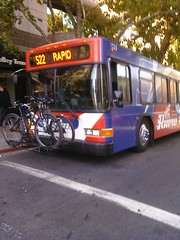
If you’ve ever seen the 522 bus you know how distinctive it is with the snazzy bright blue and red wrap covering the entire exterior, including the windows. Let me say that again…including the windows. It looks cool from the outside but from the inside looking out the view is horribly obscured by zillions of halftone screen dots. The world outside is low resolution, making it hard to see details and read street signs—a poor choice for sightseeing. It was bad enough from the driver side but once I got my coveted window seat it was even worse because the dots were right in my face. I thought about opening a window but I didn’t want the chill and I suspect my fellow passengers wouldn’t have been too happy about it either. So I squinted and craned and made the best of it but it was far from ideal.

CIMG0262

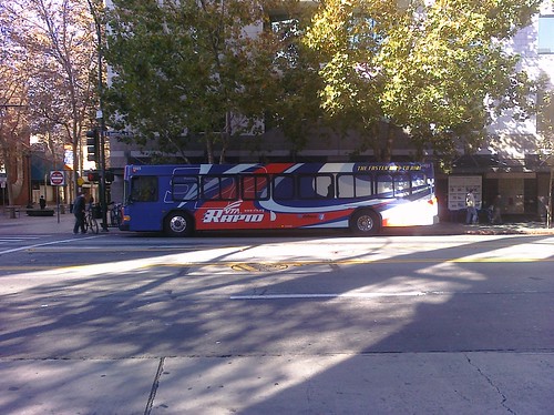
There was another problem with the 522: speed. A few seconds after I boarded the driver took off, literally leaving behind an old lady who was shuffling up the street, flagging him down. Passengers shouted for the driver to wait but he shouted back that he was late and that there were many 522s behind him. He’s right; the 522 runs every 15 minutes so I’m sure the little old lady was fine. But that was the start of a ride that can best be described as breakneck. The 522 hauls you-know-what up El Camino, pedal-to-the-metal from stop to stop. I have since learned that they even have sensors which cause traffic signals to change, like for emergency vehicles. All this efficiency is awesome for commuters but for a sightseer like me, not so much. I’m glad to have experienced it, but honestly the pixelated view of El Camino whizzing by the 522 at top speed wasn’t what I wanted. In retrospect I should have taken the VTA 22: same route, but a more relaxed schedule and clear windows. Next time.

Time : 12:40 PM
Place: Downtown San Jose
Route: VTA 522 Westbound
Fare: $0.00 w/day pass
Total: $6.00

I had my notebook out to write down things of interest. There was no way to capture everything on El Camino so I only jotted when something struck me. You would think a big old bus would be a pretty smooth ride but it turns out there’s a lot of motion which makes it difficult to write, so I tried my best. (My handwriting is not the most legible, even under ideal conditions.) I definitely wanted to be sure to record all the Historic El Camino Real bells I passed along the way. The first one was downtown San Jose near where Santa Clara Street crosses over the Guadalupe River. A little further up near HP Pavilion I could see the tents and tables in preparation for the Silicon Valley Turkey Trot the following day. The road was going to be closed on Thanksgiving Day so it’s lucky I didn’t get caught up in that. (Years ago I was not so lucky. I set out on a similar excursion to drive State Route 84 from end-to-end, Livermore to the Pacific Ocean, but after 70 miles in San Gregorio the road was closed so I never made it. D’oh!)

The bus continued onto The Alameda. I made a note of Downtown College Preparatory, the first high school we passed. Somehow I missed recording the El Camino bell there, but I did note the one a mere two blocks away at Singletary. These two bells are oddly close together.

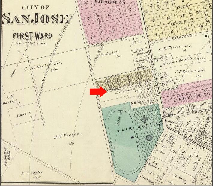
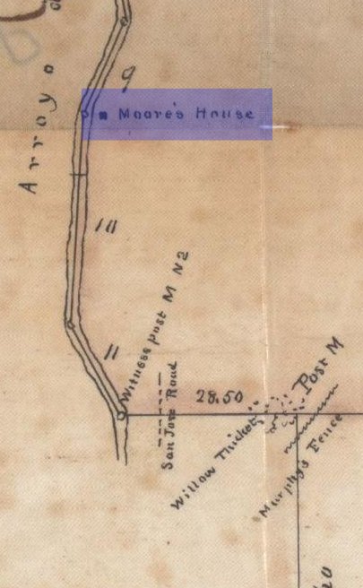
Near the Santa Clara city limit I saw a gas station and decided to count all the gas stations we passed. There’s another bell near Santa Clara University‘s Loyola Hall. That’s where we left The Alameda and where El Camino Real in name begins. I made a note of the Roxio building because as a well-known CD and DVD burning software company they stand out as one of the few household-name high tech companies conspicuous on El Camino. This road is the backbone of Silicon Valley but for some reason the tech companies have shunned it. I saw a sign for Alviso St. which was puzzling until later I checked some maps that show that Alviso St., The Alameda, and El Camino Real all confusingly combine at Mission Santa Clara and shoot out Lafayette St. which in the 1800s was the main road from the mission to the all-important port city of Alviso.

As we passed under De La Cruz Avenue El Camino took on the commercial strip character that defines so much of its length through Santa Clara and San Mateo Counties: strip malls, parking lots, driveways, and low-slung cookie-cutter architecture. I decided to start tallying fast food chain stores, notching a Jack in the Box, KFC, and a Burger King before we got to the El Camino bell at the Santa Clara Civic Center. At Bowers we crossed over some water which I learned is Saratoga Creek. At some point we passed into Sunnyvale.

I say “at some point” because it turned out to be surprisingly difficult to tell where one city ends and the next begins. Sometimes there are posted signs but they are easy to miss through pixelated bus windows. I tried to keep track of city boundaries in my notes but mostly they were just guesstimates. I wrote down that the Lucky grocery store and a Blockbuster Video just past Lawrence Expressway were in Sunnyvale (deciding to count those as well as fast food joints and gas stations), but they’re actually in Santa Clara. Who knew?

Speaking of Blockbuster, that one was closing, and it was the second closing store I had seen so far. They were hard to miss as they each had a person standing outside waving bright “Store Closing” signs and the stores carried similar banners. This was the scoop of the day as I hadn’t realized this was happening. I thought maybe the whole company had gone out of business but it wasn’t quite that bad; still it was a major reduction. This shook me as we’ve recently had not one but two neighborhood Hollywood Video stores close on us. Evidently Blockbuster is faring no better in the face of withering entertainment competition from Netflix, digital television, and the internet. I paused to reflect how I had watched the videotape and DVD rental business grow from its earliest humble beginnings to being the go-to weekend entertainment option to being on life support in a couple short decades. We’re witnessing the end of an era.

On into Sunnyvale I tallied a Carl’s Jr., a Kragen auto parts store, Safeway, Subway, Togo’s, and my first of many Taco Bells. I smiled as I recalled many good times at Golfland. I noticed that at some point the name of the road had changed to “E. El Camino Real” which reminded me of a paradox I had noticed about El Camino years ago: that somehow a single monotonic contiguous road has North, South, East, and West variants. I resolved to confirm this conundrum, and confirm it I did.

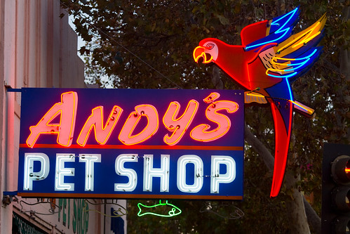
It’s been years since I’ve been to Rooster T. Feathers comedy club but what always struck me was the long list of rules and regulations they have telling you what you can and can not do. My friend Dan told me an amazing story that it used to be called Andy Capps and is where Nolan Bushnell of Atari installed the first PONG coin-operated video game prototype, and hence could be considered the birthplace of the commercial video game industry.

I noted the newly opened Sunnyvale Art Gallery and made a plan to visit soon. (I have. More later.) It was coincidental to pass the elegant Grand Hotel because I had just recently watched for the first time the famous 1932 film of the same name featuring Greta “I Vant to Be Alone” Garbo and a star-studded cast. As we were nearing the end of Sunnyvale I realized I hadn’t spotted any bells yet in the city. Just then, we passed one at Mary. I observed a closed car dealership near Bernardo and my first McDonalds, then we were in Mountain View.

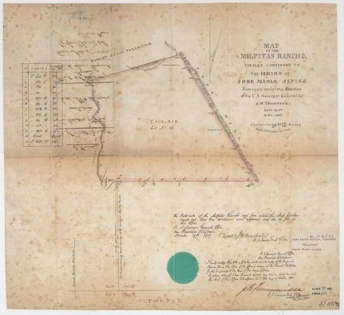
My first note was the Hotel Avante, followed shortly by the El Camino bell at State Route 85. We crossed over Stevens Creek and the Stevens Creek trail then passed Hotel Zico. There’s a tourism ad for Mountain View somewhere in there: “Need a place to stay? We have Hotels from Avante to Zico.” I spied a historical marker in front of BMW of Mountain View commemorating the “Site of Old Mountain View.” Nearby was a De Anza Trail marker at State Route 237. I imagine this crossroads was historically very significant since the road to Alviso and Milpitas was a crucial link to rest of the Bay Area before the railroads and bridges were built.

More Mountain View highlights include Amber Café, Indian Bits ‘n’ Bites and El Camino bells at Castro and at Rengstorff. By the way in these parts the road is called “W. El Camino Real.”At the San Antonio Transit Center I spotted my second The Offramp bicycle shop and the extensive Avalon Towers apartment complex. It’s always heartening to see high density housing near transit hubs and El Camino has its share. I noticed a pole-top wi-fi antenna, courtesy of Google, and a couple 24 Hour Fitnesses (48 Hour Fitness?) oddly co-located at the San Antonio Shopping Center. So long, Mountain View; hello Palo Alto.

Palo Alto Bowl made me wistful since it’s about to close after 55 years, to be replaced by a mixed-use hotel and townhouse complex. A little further up at Charleston there’s a brand new single-family housing development, Redwood Gate. I bagged a bell at Page Mill, nodded to the eminently strollable California Street, and wondered about the Ananda Church of Self-Realization at Stanford Avenue. Hits came hot-n-heavy: Palo Alto High School, a bell at Embarcadero, the now-booming Town & Country Village, and Palo Alto Medical Foundation. Shortly we turned off of El Camino into the Palo Alto Caltrain station, end of the line for the 522. It was 1:40 PM, exactly one hour after I boarded. We piled off the bus and I looked for my next connection.

Next installment…The Undiscovered County.
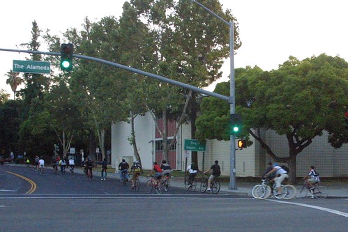