Archive for the ‘history’ Category

Feliz Aniversario

Thursday, June 3rd, 2010

CIMG0672
On this date in 1770, Father Junipero Serra celebrated the first Mass with an exploratory band of soldiers at Monterey Bay, two days after he arrived by boat. The spot shortly became the Presidio then city of Monterey. Serra founded Mission San Carlos Borromeo in nearby Carmel, the second mission in Alta California after San Diego de Alcala. San Carlos became his headquarters, the base from which he founded seven more missions, criss-crossing the land on the royal road, El Camino Real, that links them:

  • 1771 – San Antonio de Padua
  • 1771 – San Gabriel Arcangel
  • 1772 – San Luis Obispo de Tolosa
  • 1776 – San Francisco de Asis
  • 1776 – San Juan Capistrano
  • 1777 – Santa Clara de Asis
  • 1782 – San Buenaventura

Jane Stanford erected a monument to Serra at the Monterey Presidio, pictured above. This monument was placed in 1891, the same year she and Leland Stanford founded Stanford University. Stanford’s campus draws deeply from the California Mission tradition in its architecture and street names. Physically it is situated between El Camino Real and Junipero Serra Boulevard. I believe the Stanfords must have identified with the little Padre Presidente from Mallorca, admiring his piety, service, and dedication.

Junipero Serra died in Carmel at the age of 70 and is buried there today. Carmel was his final home, so his arrival and first Mass at Monterey on June 3, 1770 was especially significant. In many ways it was the start of a new life for him in Northern California.

This date is significant to me also as it’s the day I married my lovely wife, Paulette. Our wedding was June 3, 1995—225 years after Junipero Serra’s Monterey Mass. That makes today our 15th anniversary. I’m deeply grateful to her for all the support and understanding she’s given me, especially since I undertook this All Camino project last year and let it lead me all kinds of crazy directions. She’s been very kind about keeping the eye-rolls to a discreet minimum every time I come running to her with some obscure map or historical tidbit or duplicate book purchase. And as she’s one of my most faithful readers, this is for her: Happy anniversary, Honey! I love you!

Stanford Powwow

Tuesday, May 4th, 2010

Stanford Powwow

The 39th Annual Stanford Powwow is happening this weekend, Friday May 7 through Sunday May 9, 2010 (Mother’s Day!) in the Eucalyptus Grove at Stanford University, near the Stadium. I’m embarrassed to say I’ve never been, but I’m making plans finally to go this year. It’s billed as the largest student-run Powwow in the nation. The focus is Native American drumming and dance competitions, but I expect also to be dazzled by an array of arts, crafts, cultural displays, and food vendors. I’m really excited to try frybread. I don’t know what it will taste like but really with a name like that, you can’t go wrong.

Timm WilliamsThere are interesting intersections between Stanford University and local Native American history. Thousands of years before the Spanish arrived, the Muwekma Ohlone people occupied the entire Bay Area in an interwoven complex of tribal clusters. They left behind archeological remains and the vast Stanford land alone holds more than sixty excavated sites. Young Leland Stanford, Jr. used to enjoy collecting arrowheads and mortars and pestles from the property. In the 1930s the students adopted the Indian as the athletic teams’ mascot. In 1946 the “Mad Indian” logo was created, featuring an Indian caricature with a big nose. In 1952 Timm Williams (pictured), member of the Yurok Tribe (um…best tribe name ever), began appearing at sporting events as Prince Lightfoot in full Native regalia, and continued his appearances for nineteen years. In 1970 during the midst of the Indian occupation of Alcatraz, newly organized Native American students and staff petitioned University President Richard Lyman to put an end to the mascot appearances, feeling they were a mockery of Native American religion. Discussions, negotiations, and further petitions over the next few years led to the abolition of all uses of the Indian symbol and mascot, the reasoning being that they were at best insensitive and unworthy, and at worst offensive and racist. This issue continues to be controversial among alumni of the era who cherished the old mascot without meaning to give offense, and defended Williams’ sincerity.

This blog is another reason I want to go to the Powwow this year. Obviously it promises to be a spectacular El Camino event. More than that though, I hope it will help me on the difficult path of reconciling nostalgia over a romantic notion of California’s mission days with the painful reality of the suffering and injustice the Spanish and later the Americans brought to the Native inhabitants. I can look at California today and easily see the Spanish, Mexican, and Yankee influences. This weekend I want to start opening my eyes to see the Native spirit, the sublime and the profane, that dwelled in this land before the others came, and to learn to recognize how it manifests today.

No Faire?

This is the Powwow’s 39th year. This should also be the Stanford Spring Faire’s 40th year, but I can’t find any evidence that it’s happening this year or happened last year. For as long as I can remember the Powwow and Spring Faire have happened together, every year during Mother’s Day weekend. The Faire is an arts, crafts, and entertainment festival in White Plaza benefiting The Bridge, Stanford’s peer counseling service. I’ve been to the Faire many times, and every time I promise myself I’ll go to the Powwow next year. Well I’m finally going to the Powwow and go figure…no Faire. I haven’t confirmed if it’s on or off so if you know something about the Stanford Faire, tell me.

39th Annual Stanford Powwow

http://www.stanfordpowwow.org/
Mother’s Day Weekend
May 7-9, 2010
Stanford University Campus Eucalyptus Grove

Geek Dad: The Book

Sunday, May 2nd, 2010

Geek Dad.indd

Saturday night my family was delighted to attend the private book release party for Geek Dad hosted by author Ken Denmead. The party was held at Dave & Busters at the Great Mall in Milpitas. Ken is a close longtime friend, and this book launch was the culmination of an exhilarating, transformative journey for him, a dream coming true. We relished sharing this special moment with him, and rejoiced in his excitement. It was a special treat for me because I was credited as a contributor to the book.

Ken and I have known each other since the eighth grade, went to high school together, and have been good friends all along, more than two-thirds of our lives now. We got married around the same time to amazing wives and our kids are very close in age and are growing up together. (They might tell you they’re already grown.) He’s a professional engineer but he harbors many passions including movies, science fiction, internet trends, and fine food. Frankly, he’s a geek.

“Geek” used to be an insult but today it’s been reclaimed and is a self-identifying term of pride used by those whose personalities, by Ken’s definition, achieve balance in the following traits: knowledgeability, obsessiveness, and social skills. In short geeks know a lot of stuff, throw themselves with abandon into that stuff, and enjoy sharing that stuff with like-minded friends. That’s Ken.

In 2007 the editor-in-chief of Wired Magazine, Chris Anderson, started a blog under Wired’s web site called GeekDad to celebrate the intersection of geekdom and parenthood. (Despite the name, Geek Moms are equally valued, if slightly underrepresented.)  Geeks get married and have kids, and the blog is a forum for exploring ways for geeky parents to share their interests with their kids, benefiting all. Ken joined the blog as a contributor and was shortly named its editor. Under his direction the blog and accompanying podcast have exploded in popularity with dozens of writers and millions of visits, being frequently referenced by major internet and traditional media outlets. In 2008 he was approached to propose and write a book which he did with amazing vigor. About one thousand gallons of sweat and two thousand gallons of Peet’s coffee later, his baby is done and its official release date is May 4, 2010, having been duly fêted on Saturday, May 1 by his supportive family, friends, and colleagues.

CIMG0119The book is organized into fun, engaging projects geek parents can undertake with their kids. They are geek-tested, kid-approved, and vice-versa. Ken included a project I conceived to create electronic flash cards on a Sony PSP hand-held video game system to help my son study for tests without the waste and expense of old-school paper cards. He also describes a project to launch a video camera into the sky for aerial videography by attaching it to a flock of helium balloons. I spent a fun day last year helping him prototype that project; call me “Partner P2.”

flash_card

CIMG0951Naturally there are El Camino Real connections here. The book release party was at the Great Mall, which is on Main Street in Milpitas. This is part of what I call “El Camino de San Jose,” the historic road linking the San Jose Pueblo to Mission San Jose in Fremont. The Great Mall was built from the old Ford assembly plant. Further, one of the chapters in the book details a fourth-grade school project wherein his oldest son built an amazing model of Mission San Luis Rey de Francia made entirely out of cake and other edible ingredients. This model was inspired by the masterful cake creations of Charm City Cakes featured on the television program Ace of Cakes starring Geek Chef Duff Goldman. Mission San Luis is the largest in the California mission chain, founded in 1798 by Fr. Fermín Lasuén near present-day Oceanside in Southern California. By Ken’s taxonomy I’m an El Camino Real nerd today, but I aspire to be an El Camino geek. I have been to several El Camino community planning meetings, which are the closest things we have to conventions. El Camino Con?

Watch on YouTube

I asked Ken if with its tech-savvy focus this book could have been written anywhere else besides Silicon Valley. (He and his family live in Fremont which is a city that bridges Silicon Valley and the East Bay.) He believes it could have. The GeekDad blog has contributors scattered throughout the world, reflecting the fact that although so much technology innovation is centered here, content is king and is being created everywhere. I asked him how he felt at this moment and he replied, “scared and excited.” He’s always been a creative force and he has accomplished much with the blog, but having written and published a book is a milestone on a different level, a game- and potential life-changer.

I’ve read a few chapters so far and I recommend this book whole-heartedly, and not just because it was an awesome party. I should also disclose that Ken graciously gave me a complimentary copy for contributing the flash cards project to the book. It’s an enjoyable read, infused with Ken’s signature dry wit and winking geek culture in-jokes. Mother’s Day is nearly here and Father’s Day and graduations are not far behind; the book is a great gift for all occasions. The projects it contains will be perfect for upcoming summer days, ways to forge family memories more lasting than video game high scores. My son, thumbing through it, exclaimed, “This is so cool. I love this book!” It will be available starting this week from a wide variety of online and real-life retail outlets. Ken deserves every success in this remarkable endeavor. It couldn’t have happened to a nicer Geek or a more beloved Dad.

CIMG0941CIMG0946

Read Any Good Books Lately?

Sunday, April 25th, 2010

You know those Arcadia Publishing Images of America local history books? I’m talking about the sepia-toned paperbacks about a single city or region, filled with pages of old photographs and local lore. I love them. After I started researching El Camino Real I became slightly addicted to them. I couldn’t go into a bookstore without gravitating towards Arcadia’s distinctive displays and very often walked out with one or two books. I at least had the self-control to limit myself to California cities on El Camino, but more than once I brought home books only to find out I already owned them. Mockery from my wife has prompted me to make a Google bookshelf of all the Arcadia books and other books I’ve accumulated about El Camino Real and California history so far. It will help me prevent duplicates, but beyond that it’s cool to see my whole collection in one virtual place.

I have 33 books in the list as of this posting, but I know I’ll be adding more. I own most of these titles, some I’ve gotten from the library, and the rest I’ve just heard about and hope to read some day. Fact is I’ve only read three of them cover-to-cover; the rest I just thumb through or look at the pictures or use for reference. That’s how I end up with duplicates—it’s hard to remember I have a book when I haven’t read it yet. Here’s a brief overview of a few key books on the list.

San Jose's Historic DowntownI have twelve Arcadia books, all unique. (I returned the duplicates.) The first one I bought was San Jose’s Historic Downtown. I bought it years ago, before All Camino, simply because I live in San Jose and was charmed by the book. I shortly went back and bought Milpitas because I work there.  The rest I picked up after starting the blog. As I said they’re all cities on some branch of El Camino except strictly speaking Alviso, San Jose,  which is so closely interrelated to its El Caminoed neighbors that it is included honorarily. Besides, Alviso, San Jose was written by the same guy who wrote Milpitas, Robert L. Burrill. There are several eligible books in the series still that I don’t have like San Francisco’s Mission District and Colma, not to mention cities outside the Bay Area. I suspect they’ll find their way onto my shelf eventually.

The Alameda: The Beautiful Way is noteworthy because it is the only one whose author I’ve met, and I got it signed. Bay Area native Shannon E. Clarke researched, wrote, and designed it while an undergrad at UCLA and it’s a remarkable achievement, a comprehensive and indispensable historical account of my favorite El Camino stretch. I bought it on the Fourth of July, 2009, at the Rose, White, & Blue Parade and Festival. Shannon was leading bus tours of historic The Alameda and the Rose Garden. I missed the last tour, but she was kind enough to give me a quick virtual tour using one of the book’s maps as a guide. I hadn’t launched the blog yet, but finding this book was the spark that inspired me finally to get it off the ground.

California's El Camino Real and Its Historic BellsCalifornia’s El Camino Real and Its Historic Bells is golden because it’s the only book I have that is explicitly about El Camino as a road, literally telling the story of its route, passability or lack thereof, and commemoration. What it lacks in polish it more than makes up in dedication, and it contains information you can’t find anywhere else. It’s one of the books I’ve read in its entirety. If Junípero Serra is the father of El Camino Real, Mrs. A. S. C. Forbes is the mother—with apologies to Mr. Forbes and the Franciscan order. You’ll have to read the book to learn more about this dynamic woman.

Deep California: Images and Ironies of Cross and Sword on El Camino RealAnother book I’ve mentioned a few times here is Deep California: Images and Ironies of Cross and Sword on El Camino Real.  It’s an unusual work because it espouses the notion of terrapsychology, the idea that the Earth literally has a psychology and that ecological features like land masses, water bodies, and climate are outward expressions of this inner soul. Since (most) humans are from this planet, we are subconsciously attuned to this psychology and play out its archetypical facets through our individual and societal behaviors. If we act contrary to nature, it reacts in kind. It’s a powerful idea, and the book is a fascinating colorful romp through the stories of California, picking out recurring themes from the human realm that reflect deeper root causes of place and pointing out the mistakes of the past so that we may learn from them. This book means a lot to this blog because it validates the approach I’ve taken, that there is a different way to tell the story of El Camino Real: that the road we experience materially may be interpreted symbolically as a path to deeper truths.

Oh, California, 21st Century EditionAs I read Deep California—front-to-back, and it’s big—I realized I knew very little about California history. I didn’t know Portolá from a pueblo or De Anza from adobe. How embarrassing. Every California schoolchild learns state history in the fourth grade (mission projects!) and I remember seeing this stuff in my son’s social studies book when he was in that grade but I don’t remember what I read in mine a generation prior. So I had a brilliant idea: I bought two grade school textbooks, Oh, California and Social Studies: California Edition, both published by Houghton Mifflin.  One of them is used which makes it very special. (Thanks, Kris, wherever you are, for your responsible stewardship, and I promise to provide the same.) They are a gentle introduction to a daunting subject, they represent at a curricular level what the state believes every citizen should know, and they contain plenty of colorful graphs and pictures. I like pictures. I may not be smarter than a fifth grader, but with these books close at hand I at least have a shot at holding my own.

A last few mentions. Historic Spots in California is I believe the California Bible, and Clyde Arbuckle’s History of San Jose is the San Jose Bible. Historical Atlas of California turned me into a mapaholic overnight. The Labors of the Very Brave Knight Esplandián, a romantic novel written around 1500 by Garci Rodríguez de Montalvo of Spain, is the origin of California’s name. It includes an account of Calafía, the fierce black Amazon queen of the then-fictional island California, who wore armor made of gold as she battled the handsome Catholic hero Esplandián in the first bloody Crusade. She was defeated honorably so she subjected herself and her queendom to Christianity. Allegory much?

Each time I crack open one of these wonderful books I learn something new. The story of this great state is rich and enlightening, but impossibly complex. Studying how El Camino Real slices through it all is an effective way to get a clarifying cross section of history. Moreover the more general a book is, the more carefully I have to comb through it to find information specific to the road, and the more rewarding and thrilling is each golden find. I wish for the time and patience to someday read them all. Unless they make a movie first.

El Camino de San Jose

Saturday, April 10th, 2010

One of life’s more mysterious delights is synchronicity, those moments when you experience a startling coincidence that impresses your instinct as having special meaning that may defy logic. I’ve been enjoying several of these “whoa” moments with respect to El Camino Real since I started this project.

Here’s an example. The afternoon of September 25, 2006 I read the landmark article “What Is Web 2.0” by Tim O’Reilly. It had been written a year earlier, but I’ve always been behind in all things web. I read it, I “got” it, and was inspired to create a web site as a way finally to express this ticklish notion I’ve had for a while of celebrating El Camino Real. The name came to me like a thunderbolt: AllCamino.com. Later that evening I was browsing the San Jose Mercury News online and was astonished to read an article published that same day called “Bringing face-lift to historic road” which was all about the Grand Boulevard Initiative of Joint Venture: Silicon Valley Network, a multi-city drive to revamp El Camino into a unique, thriving street for the 21st century. It was fate; it reinforced that El Camino has a story to be told. I registered the domain name immediately.

CIMG0150Here’s another. I registered the domain in 2006 but didn’t get around to creating this blog at the site until August 11, 2009. (I told you I’m always behind.) I accomplished this milestone with my laptop at the San Jose Library Rose Garden branch using their free wi-fi. After creating the blog, to celebrate I drove up Naglee Avenue and down The Alameda to Tee Nee Thai for lunch. On the way I happened to see the Hester Park gates at Singletary Avenue. I had never noticed them before and I wondered what “Hester Park” meant. Was there really a park? Aha, an El Camino mystery to investigate! So after lunch I walked back up to Singletary and took some photos of the gates. I walked down Singletary several blocks to look for a park. I didn’t find one so I turned right on Park Avenue, passed Hoover Middle School and the Egyptian Museum, turned right again at Naglee and walked all the way back up to The Alameda, a big loop. Then inspiration struck again. Since it was a beautiful day I decided to walk the entire length of The Alameda from that point all the way down to the Caltrain underpass and back. That day I “did” The Alameda; what better way to celebrate the launch of AllCamino? An ice cream cone from Schurra’s consecrated the occasion. My walk all started with that happenstantial glimpse of the Hester Park gates; none of it was planned, I just followed a series of whims. A few months later in January 2010, I was studying an old map of San Jose and realized that Singletary Avenue wasn’t always called that; it used to be called Moore Street after Judge John Hendley Moore who owned that land. My last name is Moore, no relation to the judge. So yeah, without knowing it I marked the beginning of my El Camino career at the intersection of Moore and The Alameda. Mind-blowing. Did I mention there’s a bell right there? As a humorous postscript, I discovered there is no Hester Park on Singletary/Moore after all; that was the name of an old housing subdivision there. However I did find an actual Hester Park very nearby…a teeny tiny playground adjacent to the San Jose Library Rose Garden branch, the very same branch where I launched this blog. Ba doom, crash!

Moore St

That’s all kid stuff. Here’s synchronicity’s grandma with respect to El Camino Real and me.

Shortly after I launched the blog I went looking for books about El Camino, or at least with “El Camino” in the title. I bought two for their distinctiveness: Deep California: Images and Ironies of Cross and Sword on El Camino Real by Craig Chalquist, PhD, and California’s El Camino Real and Its Historic Bells by Max Kurillo and Erline Tuttle. The latter contains a reproduction of a 1912 AAA road map showing the length of El Camino from San Diego to San Francisco. It answered a mystery for me. El Camino nominally links the missions, but Mission San José in Fremont is nowhere near today’s El Camino Real. So what route did early Californians take from Mission Santa Clara to Mission San José? I had assumed the route ran down The Alameda to Santa Clara Street in San Jose to Alum Rock Avenue, perhaps running north along the foothills on Piedmont Road. The 1912 map suggested something different. It shows El Camino entering San Jose from the south as Monterey Road/First Street then splitting. One branch goes west to The Alameda as expected, but the other branch continues along First Street then turns east somewhere around Gish Road, then turns north on Old Oakland Road. There it continues along Main Street and Milpitas Boulevard in Milpitas, to Warm Springs Boulevard in Fremont, to Mission Boulevard which runs right to Mission San José. So there’s the route, which I like to call El Camino de San Jose.

Here’s the thing. I live on Old Oakland Road. I live on El Camino de San Jose.

I’ve lived there for over ten years. I had no idea about its mission connection. This knowledge did not inform my decision to buy the house, nor did it impact my interest in El Camino Real or motivations to start the blog. I had always assumed Old Oakland Road was simply the old road to Oakland, later replaced by Interstate 880, and never thought more about it than that. To tell the truth I had been feeling naggingly incomplete blogging about El Camino when I didn’t actually live or work on it. I didn’t have standing. But guess what, I do after all and I learned all this after the fact. Astounding.

A 1912 map is pretty old, but it’s a lot more recent than 1797 when Mission San José was founded. I embarked on a quest to find older maps that show this road. I bought a bunch of well-known San Jose maps from eBay, Lord help me. The David Rumsey Historical Map Collection has also been helpful, however the Online Archive of California, in particular the UC Berkeley Bancroft Library collection, has been absolutely indispensable in this research. They have high-resolution scans of the California land case maps, evidence the Mexican rancho owners presented in their petitions to the U.S. government for the rights to the land. “Transfer” of land ownership is of course the fundamental moral, ethical, and legal quandary in California’s past, but the records generated shed light on state history. The following two maps are the keys for me to El Camino de San Jose.

The first is a free-hand map or diseño of North San Jose dating from the 1840s. I first found it in the Historical Atlas of California by Derek Hayes. It clearly shows “El Camino Nacional” (in some maps the name changed from “Real” (“Royal”) to “Nacional” (“National”) to reflect Mexican independence from the Spanish crown) running to the San Jose pueblo from the south, then branching off as “El Camino de San Jose” to the north in the direction of the mission which unfortunately is not shown. This camino crosses Coyote and Penitencia Creeks (“Arroyo de Collotes” and “Arroyo de la Penitencia“), and I contend that this road is Oakland Road today. Oakland Road still crosses Coyote Creek in front of the San Jose Municipal Golf Course, and it used to cross Lower Penitencia Creek in front of Orchard School before the creek was radically altered into submission.

ECdSJ_diseno

The next map shows only Milpitas, but this time it’s an official survey from 1857. It’s so dead-on accurate I can overlay it on a modern map and details like roads and historic buildings line up perfectly. It’s irrefutable that the road labeled “San Jose Road” on the survey is Oakland Road today. It hasn’t moved in over 150 years.

ECdSJ_survey

To recap, my thesis is that at least as far back as 1797 the Spanish must have had a road that connected Mission Santa Clara and the San Jose pueblo with Mission San José, and that Oakland Road today is part of it. The 1840s rough diseño shows such a road labeled “Camino de S. Jose” that approximately corresponds to physical features of Oakland Road. It unfortunately doesn’t show Mission San José but there’s a suggestive ambiguity in the name “Camino de S. Jose;” it’s the perfect name for a road connecting Pueblo de San José to Mission San José. It’s reasonable to conclude that “Camino de S. Jose” on the diseño is “San Jose Road” on the 1857 survey; it’s a direct Spanish-to-English translation. The survey proves topographically that San Jose Road then is Oakland Road now, and that’s where I live.

I’m no historian so I can’t say how much proof is proof enough, and I recognize there are holes in my maps. For example on the diseño the road crosses Penitencia Creek at the wrong spot, but I’m willing to attribute that to either map error or shifts in the creek over time. On the other hand, I’ve read at MilpitasHistory.org and other sites that Penitencia Creek was so named because the padres from Mission Santa Clara and Mission San José would periodically meet in an oak grove along its bank and give penance to each other and to the native Ohlone. I’m writing a song about it:

How’d the padres get to San Jose?
They drove on Oakland Road, and stopped to pray along the way…

So I’m convinced. And if that weren’t enough, this little detail from the southwest corner of the property in the 1857 survey grabbed my attention and drove the point home to me.

ECdSJ_survey_detail

Synchronicity. It’s a trip.

I have a much deeper personal connection to El Camino Real than I ever realized or may ever understand. So far it’s been fun and exciting, the experience of a lifetime as I try to hear what it’s saying to me. I will henceforth widen the scope of this blog to include the historic East Bay as well as the Peninsula. I look forward to following this road. Who knows where it goes?

A Pilgrim’s Odyssey, or There and Back Again, Part 3

Saturday, March 27th, 2010

CIMG0266

The Palo Alto Caltrain station was the county-nental divide for my transit trip up El Camino Real. It’s where I left the VTA system which serves Santa Clara County, and boarded the SamTrans Route 390 bus which serves San Mateo County. I had a few minutes to wait so I spent them studying the posted maps and schedules. That’s when I spotted a notice that was as welcome as it was unexpected: select VTA and SamTrans routes accept each others’ day passes in Palo Alto. I could use my VTA pass to board the SamTrans 390! For free! Sweet!

Time : 1:50 PM
Place: Palo Alto Caltrain Station
Route: SamTrans 390 to Daly City BART
Fare: $0.00 w/VTA day pass!
Total: $6.00

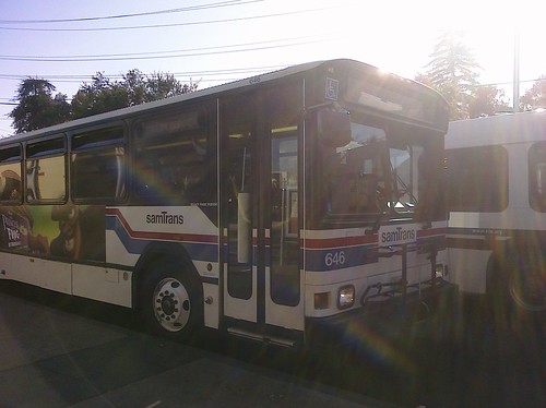
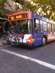
The 390 arrived after a few short minutes. It was an impressive articulated coach. I boarded and flashed my VTA pass with just a hint of nervousness that it would be rejected, but my papers were indeed in order so I had no problem at all. The train station is the startpoint for this route so the bus was empty. I had my choice of seats and selected one on the right side as I planned, stowed my backpack at my feet, and settled in for the long ride up the Peninsula.

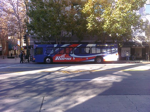
I’ve lived in Santa Clara county for a while now and I like to think I brim with civic pride, but I have to say honestly that the SamTrans 390 was nice. Really nice. Frankly it blew the VTA 522 off the road, which pains me to admit. The windows were clear (no wrap!), the seats were comfy, and the air conditioning was luxurious. Best of all its general pace was much more leisurely. As we pulled out of the station past the historical marker at MacArthur Park and turned onto El Camino, I could literally feel myself relax as I sat back and prepared to enjoy the ride.

I hate to bag on VTA but I’ve always been ambivalent towards it. There was a period when I took it every day to work and regularly took it to special events downtown. It’s an adequate system, but I wish I could say it’s great. The fact is it’s troubled with low ridership, high fares, and increasingly infrequent schedules. Part of the problem is that the county, especially San Jose, is so gosh-darned spread out with relatively little population concentration that it’s tough to service it efficiently. Plus in our history we’ve been blessed with some boom times, most recently around the high tech industry, that resulted in a solid suburban middle class and drove the adoption of a car culture. So our buses are not world-class. I do have hope for the future of VTA given new high-density development around transit hubs and the plans I’ve seen for dedicated-lane Bus Rapid Transit, but we’re not there yet.

Back to SamTrans, I noted with approval the aptly named El Camino Park as we drove by, then tried and failed to spot El Palo Alto the landmark tree as we crossed San Francisquito Creek; I think it’s just not visible from El Camino. And then just that quickly we left Palo Alto, left Santa Clara County, crossed into San Mateo County, entering Menlo Park.

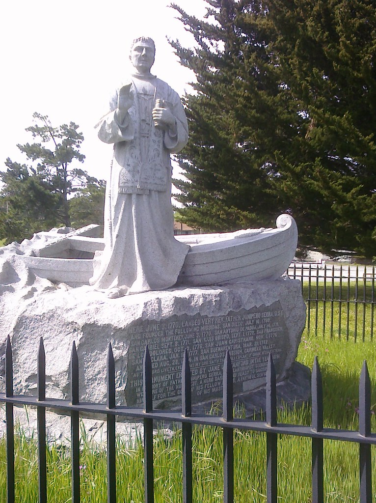
The Tesla Motors dealership is a hopeful spark in contrast to the three or four closed car dealerships just up the street. There are still plenty of gas stations though, additional reminders of El Camino’s car-serving nature. Jeffrey’s Hamburgers stands out as an eye-catching diner; I’ll have to check it out soon but it will be competing with some of my favorite burger joints past and present on El Camino. At Ravenswood I saw the first historical bell of the county and it was a standout because it’s the first I’ve seen that isn’t hanging from a trademark shepherd’s crook guidepost. Rather it’s hanging on a yoke which I presume is how they were mounted in the actual missions.

CIMG0271

I took pictures of this bell, and these were pretty much the only photos I managed to take out the bus windows all day. The only reason I got these is that I lucked out and the bus was stopped at a lengthy red light. I had planned to take many more, but I was overwhelmed simply trying to look vigilantly out the windows without missing anything. It was hard enough just taking notes; photos were beyond me.

The light finally turned green and I was treated to the ultra-hip Menlo Center and the sublime Kepler’s Books. I noted a historical marker at Triangle Redwood Grove, and that Gaylord Indian Restaurant had closed. Gaylord at the Stanford Shopping Center used to be a favorite with my family and my college roommate. I still miss it.

Soon the businesses went away and El Camino became all trees, fences, walls, and the backsides of really expensive homes. Welcome to Atherton. Many of these houses back right up to El Camino, but I presume none of them has an El Camino address. When the neighborhoods cleared and we got to the business district it felt very close with two-story buildings butting directly against the sidewalk, like a tall narrow corridor. There’s a distinct village feel, but severe and a little creepy, like the kind of place you read about in pulpy horror stories. Pleasantville by day but at night, no one will hear your screams…

Atherton is wide but short so before I knew it we rolled into Redwood City. I jotted something about “SF Water Dept.” but have no idea what that was a reference to. I may have become distracted because around this time the air conditioning on the bus shut off and the heat snapped on, throwing me for a loop. We passed the Target at Charter Street then the SR 84 junction, our first highway crossing in quite a while. Harry’s Hofbrau made me nostalgic with its old-timey decor. There’s an El Camino bell posted nearby at Chestnut Street, welcoming you to town. Franklin Street Apartments provide some residential density convenient to the shops and transit at bustling Sequoia Station, but Maguire Correctional Facility looms soberly behind it. A quick look down Broadway reveals a classic and historic downtown (“Climate Best by Government Test”). The Ben Frank’s hot dog stand is as iconic and appetizing as ever, but it overlooks the too-close at-grade Caltrain crossing which was the scene of a shocking tragedy last year. I chuckled at the odd alternating type sizes on an “EL CAMINO REAL” street sign, then noted with satisfaction that the Caltrain tracks are at a higher, safer grade by the time it crosses over Howard Ave. This stretch has some big culverts which are cool to look at. Somewhere along the line I noticed a couple free newspaper boxes for the Daily Post and Daily News.

As we cruised into San Carlos I stuck dogmatically to my strategy of only observing the right side of the street. That’s when I discovered that in San Carlos, there is no right side of the street, just gravel lots and train tracks. The Caltrain tracks are so close to the road there’s no room for proper businesses so most of it is left open. The businesses that should be there seem to be on the other side of the tracks, on Old County Road. The San Carlos Caltrain depot at San Carlos Avenue however is an eye-catching exception, and is graced with a bell. Things open up shortly and there’s a posted notice for proposed development north of the station, which is a recurrent theme. San Carlos Plaza, a shopping center, leaves no doubt that the right side of El Camino is indeed open for business. Trivia break: this paragraph contains the name “San Carlos” seven times. San Carlos.

Belmont is frankly more of the same. There’s a bell near Harbor Blvd. and another at the Belmont Caltrain station at Ralston Ave. By then the right side narrows to a gravel lot again. Then something surprising happens: El Camino must gain a little elevation because the sight lines clear and you gain an expansive view of the San Mateo Bridge and the East Bay hills. Google Street View tells me this occurs around Marine View Street and Mountain View Avenue. Someone was paying attention when they named those streets.

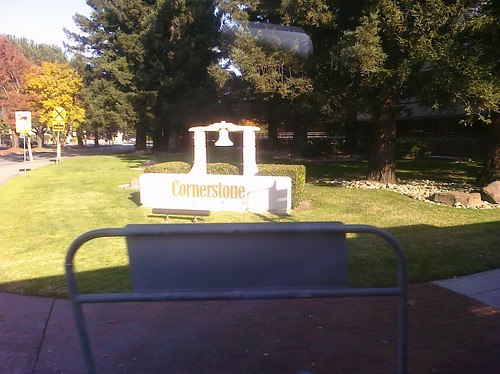
Now entering San Mateo, the county namesake. I had assumed it is the largest and most populous city in the county, but sadly it is neither. However we started to hit the first heavy traffic of the day around SR 92 so clearly it’s big and populous enough. The first thing I wrote down is there are no sidewalks at 42nd Avenue. Yumi Yogurt was a happy sight at 38th Avenue but it has no sidewalk either. I noted Hillsdale Shopping Center even though it’s on the other side of the street; an unforgivable mental lapse. However I was back on track with Ana Furniture which stands on the correct side of the street, across from the mall. Peninsula Station is a mixed-use development appealingly sandwiched between El Camino and Caltrain. This section has a kind of retro downtown feel with small sidewalks culminating with the highrise Tower Plaza building. There was a line out the door at Heidi’s Pies, people no doubt picking up orders for Turkey Day desserts. There was no rush though because Heidi’s never closes. Ever. Bridge Point Academy was the first school I had seen in a while, and The Beading Frenzy wins for the best business name of the day. My wife and my mom have both been into beading; the imagery in the name describes the ensuing mania perfectly. Scenic Central Park is bounded by 5th Avenue—a sly homage to Manhattan geography—and is the gateway to downtown San Mateo. There’s a multi-level parking garage at 2nd Street which is great since downtown is so strollable.

One notices that there are a lot of churches on El Camino in northern San Mateo. The Church of St. Matthew and St. Matthew’s Episcopal Day School occupy beautiful grounds near St. Matthews Avenue. Notably up to this point in San Mateo the street signs say “S El Camino Real” but here they switch to “N El Camino Real.” Indeed the address of the church is One South El Camino Real and this is where the numbered cross streets begin, starting with 1st Avenue and continuing into the forties as you proceed south. San Francisco and Santa Clara of course were Spanish Catholic missions that became cities and counties. San Mateo separates them but there was never a mission here, rather a satellite Franciscan outpost where San Mateo Creek—whence the region got its name—crossed the Royal Road. It’s notable then that here at the equator of the city, where north becomes south, on the El Camino virtual meridian there is no Catholic chapel but rather an Episcopal church. The Episcopal “big-C” Church as an institution was founded during the American Revolution to replace the Church of England in the newly independent nation. So in a sense the Episcopal Church of St. Matthew, built in 1865 on the site of the abandoned mission outpost, represents the region’s Americanness, a Yankee stake in the Ohlone-then-Spanish-then-Mexican ground, the footprint where Mateo got kicked out and Matthew was shoed in. Fittingly here at the crux of San Mateo’s history and culture is placed an El Camino bell marking the spot where a mission might have been.

My parents live in San Mateo, a short stroll from El Camino. As it turned out, it took nearly three hours to get to their house from mine by bus, an amusing family factoid. I’m tempted to laugh at how impractical this mode of transportation seems, but in fact there was a passenger who got on the 522 with me in San Jose, transferred to the 390, and got off in San Mateo. People do it. As I was pondering this we entered Burlingame and were reminded by a familiar historical marker that Juan Bautista de Anza had been there 230 years prior. A public parking lot at Burlingame Avenue is convenient for shoppers and diners. Near Floribunda Avenue I spied a bell and not much further the wonderful onion domes of the Church of All Russian Saints. Russians have a long history in California, but that’s a topic for another time. Crossing Broadway downtown gave me a sense of déjà vu, having crossed Broadway in Redwood City already. There seems to be nothing but churches and apartments here, and I was struck how there were no pedestrians. After the businesses and apartment buildings faded we entered another zone of backside fences shielding single-family dwellings, similar to Atherton. The difference here though is the corps of venerable landmark eucalyptus trees. A bell at Rosedale and Peninsula Medical Center at Trousdale were my final Burlingame observations.

In my life I’ve been to San Mateo too many times to count and to Burlingame maybe a dozen or two, but north of there San Mateo County is the wild unknown to me. Some of those cities I’ve been to a handful of times and others not at all to speak of, particularly not their El Camino profiles. It was actually kind of wonderful finally to experience these cities which are household names but which I had only visited in Google Maps excursions. Let me tell you, when you start a blog about a street, you wind up spending a lot of time in Google Maps. A lot. This in a nutshell is why I undertook this trip. There’s no substitute for being there.

At Millbrae Avenue this bus turned off of El Camino for the first time to stop at the spectacular intermodal bus-BART-Caltrain Millbrae station. That’s when I realized how close El Camino is to US 101 here, probably the closest I came all day. By now it was after 3:15PM so school kids started boarding the bus, happy and chatty, ready for their long holiday weekend. Their presence brought a lively if slightly rowdy change of atmosphere. Back on El Camino, on the 1000 block there’s a bell. A little further a tree in front of the Mission revival Best Western El Rancho bears some kind of historical marker, but I don’t know what it signifies.

San BrunoSan Bruno gets a standing ovation: their street signs sport their city seal which contains not one but two bells. Bravo! Now that’s some El Camino pride. In reality much of El Camino here is a commercial hodgepodge. It is happily broken up at “The Avenue” A.K.A. San Mateo Avenue, San Bruno’s deliberately-branded downtown shopping district. There is an actual bell here, presumably the model for the seal. I wonder though how those traditional downtown storefronts fare in the shadow of The Shops at Tanforan and San Bruno Towne Center. Malls kill commercial strips; that’s the perennial challenge for city planners. So is traffic, which again got heavy as we approached I-380. I don’t think I’ve ever been to Tanforan, and I was until now unaware that there’s a Hooters there, right on El Camino. Look for more in a future post. I will of course be looking for signs of improved morale and career advancement opportunities after their CEO’s epiphany on “Undercover Boss.” Plus I want to see the barstool trick.

This is where I became aware of San Bruno Mountain rising before us. Ironically it is actually in South San Francisco, “The Industrial City.” The mountain really anchors and defines South City. There’s something else in South San Francisco: the headquarters of See’s Candies. I love candy and I love chocolate; I wonder if they give tours? After a while I noticed the road starting to ascend, and sure enough by the time we got to W. Orange Avenue we had gained a bit of altitude as we started to cross the northern tip of the Santa Cruz Mountains. I saw some big honking crows here. Kaiser Permanente Hospital looms large and Park Station condos and Archstone Apartments cozy up to the South San Francisco BART station, which again we had to turn off of El Camino to get to. The bus passed a Costco I had actually stumbled upon once years ago while looking for gas, and nearby there’s a bell. Treasure Island RV Park has a playful name. Here’s something to ponder. San Francisco and South San Francisco are in different counties, as are Palo Alto and East Palo Alto. Fascinating.

Something else that’s fascinating is the city of Colma, “City of Souls.” To make a long story short, in 1900 it became illegal to be dead in San Francisco so Colma grew as a city of cemetaries to hold the San Francisco deceased.  As you roll through Colma it’s literally cemetary after cemetary after cemetary. King of them all, at least from a bus on El Camino, is Cypress Lawn. Holy Sepulchre, Batman, is it ever gorgeous with manicured lawns, serene landscaping, and elegant structures. A nice place to visit. People do actually live in Colma, as evidenced by their landmark police station, and it has a homey village feel. Colma does have a bell, right in front of Eternal Home. Bill Graham is buried there. Here though there are graves just feet away from El Camino which was somehow a bit shocking, but a frank reminder that not every final resting place is a country club. I made a note of pedestrians at the walkway to D street; it could be they were the first people I saw in town. Sidebar: the Colma Historical Association claims that “Colma” is an Ohlone word meaning “many springs” but I don’t buy it. I’m convinced it’s an acronym for “City Of” something, but I don’t know what yet. “Lawn-Mowed Acres”? “Little Motion Anywhere”? “Last Mortal Address”? What do you think?

I noticed the street signs changed to some cool-looking blue ones with a bird logo and indeed the street name itself changed to Mission Street which means we were finally in Daly City. Mission Plaza at Citrus Avenue is a large retail center and there’s a bell in front. The War Memorial Community Center and John Daly Library complex are newly remodeled civic jewels and Landmark Plaza are condos in progress. My main impression was how similar Daly City is to San Francisco, dense and hilly. A spectacular view of Sutro Tower, not to mention some distinctly urban traffic, underscored this notion. Then at long last we reached the storied top-of-the-hill in Daly City, which I was very satisfied to see has a bell planted firmly at its peak in a place of honor. I’ll go out on a limb and claim without substantiation that this is the highest-altitude and westernmost bell in the Bay Area.

The bus turned off Mission onto Hillside to head down to the Daly City BART station, the end of the line. It was about 4:00 PM. I gathered my things, disembarked, and prepared to board Muni for the final push into San Francisco.

Next installment…Do You Know the Way to…?

A Pilgrim’s Odyssey, or There and Back Again, Part 2

Saturday, March 13th, 2010

CIMG0264

Whereas the 66 was a calm low-key ride, the 522 was a grittier urban experience. It was nearly full so I was lucky to find a seat near the back like I wanted, but it was on the driver’s side. I had wanted to sit on the passenger side so I could observe the east side of El Camino as we traveled north. I was going to be hard-core about this, ignoring everything on the left (west) side of the street, only looking at the right (east) side. I would catch the west side on the return trip. Great plan, right? For it to work I needed to be on the right side of the bus so I resolved to bide my time and switch seats as soon as one became available. Fortunately the view out the passenger-side windows was not too bad from across the aisle.

If you’ve ever seen the 522 bus you know how distinctive it is with the snazzy bright blue and red wrap covering the entire exterior, including the windows. Let me say that again…including the windows. It looks cool from the outside but from the inside looking out the view is horribly obscured by zillions of halftone screen dots. The world outside is low resolution, making it hard to see details and read street signs—a poor choice for sightseeing. It was bad enough from the driver side but once I got my coveted window seat it was even worse because the dots were right in my face. I thought about opening a window but I didn’t want the chill and I suspect my fellow passengers wouldn’t have been too happy about it either. So I squinted and craned and made the best of it but it was far from ideal.

CIMG0262

There was another problem with the 522: speed. A few seconds after I boarded the driver took off, literally leaving behind an old lady who was shuffling up the street, flagging him down. Passengers shouted for the driver to wait but he shouted back that he was late and that there were many 522s behind him. He’s right; the 522 runs every 15 minutes so I’m sure the little old lady was fine. But that was the start of a ride that can best be described as breakneck. The 522 hauls you-know-what up El Camino, pedal-to-the-metal from stop to stop. I have since learned that they even have sensors which cause traffic signals to change, like for emergency vehicles. All this efficiency is awesome for commuters but for a sightseer like me, not so much. I’m glad to have experienced it, but honestly the pixelated view of El Camino whizzing by the 522 at top speed wasn’t what I wanted. In retrospect I should have taken the VTA 22: same route, but a more relaxed schedule and clear windows. Next time.

Time : 12:40 PM
Place: Downtown San Jose
Route: VTA 522 Westbound
Fare: $0.00 w/day pass
Total: $6.00

I had my notebook out to write down things of interest. There was no way to capture everything on El Camino so I only jotted when something struck me. You would think a big old bus would be a pretty smooth ride but it turns out there’s a lot of motion which makes it difficult to write, so I tried my best. (My handwriting is not the most legible, even under ideal conditions.) I definitely wanted to be sure to record all the Historic El Camino Real bells I passed along the way. The first one was downtown San Jose near where Santa Clara Street crosses over the Guadalupe River. A little further up near HP Pavilion I could see the tents and tables in preparation for the Silicon Valley Turkey Trot the following day. The road was going to be closed on Thanksgiving Day so it’s lucky I didn’t get caught up in that. (Years ago I was not so lucky. I set out on a similar excursion to drive State Route 84 from end-to-end, Livermore to the Pacific Ocean, but after 70 miles in San Gregorio the road was closed so I never made it. D’oh!)

The bus continued onto The Alameda. I made a note of Downtown College Preparatory, the first high school we passed. Somehow I missed recording the El Camino bell there, but I did note the one a mere two blocks away at Singletary. These two bells are oddly close together.

Near the Santa Clara city limit I saw a gas station and decided to count all the gas stations we passed. There’s another bell near Santa Clara University‘s Loyola Hall. That’s where we left The Alameda and where El Camino Real in name begins. I made a note of the Roxio building because as a well-known CD and DVD burning software company they stand out as one of the few household-name high tech companies conspicuous on El Camino. This road is the backbone of Silicon Valley but for some reason the tech companies have shunned it. I saw a sign for Alviso St. which was puzzling until later I checked some maps that show that Alviso St., The Alameda, and El Camino Real all confusingly combine at Mission Santa Clara and shoot out Lafayette St. which in the 1800s was the main road from the mission to the all-important port city of Alviso.

As we passed under De La Cruz Avenue El Camino took on the commercial strip character that defines so much of its length through Santa Clara and San Mateo Counties: strip malls, parking lots, driveways, and low-slung cookie-cutter architecture. I decided to start tallying fast food chain stores, notching a Jack in the Box, KFC, and a Burger King before we got to the El Camino bell at the Santa Clara Civic Center. At Bowers we crossed over some water which I learned is Saratoga Creek. At some point we passed into Sunnyvale.

I say “at some point” because it turned out to be surprisingly difficult to tell where one city ends and the next begins. Sometimes there are posted signs but they are easy to miss through pixelated bus windows. I tried to keep track of city boundaries in my notes but mostly they were just guesstimates. I wrote down that the Lucky grocery store and a Blockbuster Video just past Lawrence Expressway were in Sunnyvale (deciding to count those as well as fast food joints and gas stations), but they’re actually in Santa Clara. Who knew?

Speaking of Blockbuster, that one was closing, and it was the second closing store I had seen so far. They were hard to miss as they each had a person standing outside waving bright “Store Closing” signs and the stores carried similar banners. This was the scoop of the day as I hadn’t realized this was happening. I thought maybe the whole company had gone out of business but it wasn’t quite that bad; still it was a major reduction. This shook me as we’ve recently had not one but two neighborhood Hollywood Video stores close on us. Evidently Blockbuster is faring no better in the face of withering entertainment competition from Netflix, digital television, and the internet. I paused to reflect how I had watched the videotape and DVD rental business grow from its earliest humble beginnings to being the go-to weekend entertainment option to being on life support in a couple short decades. We’re witnessing the end of an era.

On into Sunnyvale I tallied a Carl’s Jr., a Kragen auto parts store, Safeway, Subway, Togo’s, and my first of many Taco Bells. I smiled as I recalled many good times at Golfland. I noticed that at some point the name of the road had changed to “E. El Camino Real” which reminded me of a paradox I had noticed about El Camino years ago: that somehow a single monotonic contiguous road has North, South, East, and West variants. I resolved to confirm this conundrum, and confirm it I did.

It’s been years since I’ve been to Rooster T. Feathers comedy club but what always struck me was the long list of rules and regulations they have telling you what you can and can not do. My friend Dan told me an amazing story that it used to be called Andy Capps and is where Nolan Bushnell of Atari installed the first PONG coin-operated video game prototype, and hence could be considered the birthplace of the commercial video game industry.

I noted the newly opened Sunnyvale Art Gallery and made a plan to visit soon. (I have. More later.) It was coincidental to pass the elegant Grand Hotel because I had just recently watched for the first time the famous 1932 film of the same name featuring Greta “I Vant to Be Alone” Garbo and a star-studded cast. As we were nearing the end of Sunnyvale I realized I hadn’t spotted any bells yet in the city. Just then, we passed one at Mary. I observed a closed car dealership near Bernardo and my first McDonalds, then we were in Mountain View.

My first note was the Hotel Avante, followed shortly by the El Camino bell at State Route 85. We crossed over Stevens Creek and the Stevens Creek trail then passed Hotel Zico. There’s a tourism ad for Mountain View somewhere in there: “Need a place to stay? We have Hotels from Avante to Zico.” I spied a historical marker in front of BMW of Mountain View commemorating the “Site of Old Mountain View.” Nearby was a De Anza Trail marker at State Route 237. I imagine this crossroads was historically very significant since the road to Alviso and Milpitas was a crucial link to rest of the Bay Area before the railroads and bridges were built.

More Mountain View highlights include Amber Café, Indian Bits ‘n’ Bites and El Camino bells at Castro and at Rengstorff. By the way in these parts the road is called “W. El Camino Real.”At the San Antonio Transit Center I spotted my second The Offramp bicycle shop and the extensive Avalon Towers apartment complex. It’s always heartening to see high density housing near transit hubs and El Camino has its share. I noticed a pole-top wi-fi antenna, courtesy of Google, and a couple 24 Hour Fitnesses (48 Hour Fitness?) oddly co-located at the San Antonio Shopping Center. So long, Mountain View; hello Palo Alto.

Palo Alto Bowl made me wistful since it’s about to close after 55 years, to be replaced by a mixed-use hotel and townhouse complex. A little further up at Charleston there’s a brand new single-family housing development, Redwood Gate. I bagged a bell at Page Mill, nodded to the eminently strollable California Street, and wondered about the Ananda Church of Self-Realization at Stanford Avenue. Hits came hot-n-heavy: Palo Alto High School, a bell at Embarcadero, the now-booming Town & Country Village, and Palo Alto Medical Foundation. Shortly we turned off of El Camino into the Palo Alto Caltrain station, end of the line for the 522. It was 1:40 PM, exactly one hour after I boarded. We piled off the bus and I looked for my next connection.

Next installment…The Undiscovered County.

El Camino International Airport

Wednesday, November 25th, 2009

KTVU_Airport
Tomorrow is Thanksgiving which means that today, Wednesday, the day before Thanksgiving is (cue graphics) “The Busiest Travel Day of the Year.” This is the day that many Americans hop on a plane, train, or highway to visit loved ones for the holiday or enjoy a long weekend getaway. A favorite tradition in our household is to watch the Wednesday morning television news broadcast because they invariably send a reporter to an area airport to cover this annual non-story. Usually they send the most junior reporter in what I’m sure is a rite of passage. Occasionally I think more seasoned reporters volunteer for the assignment and show up with their bags packed so they can hop on a plane as soon as the broadcast is done. It’s a free ride to the airport!

CIMG0005Our closest airport is Norman Y. Mineta San José International Airport (SJC). We generally don’t fly for Thanksgiving but last month we did get a chance to fly out of the brand new Terminal B Concourse. It started out a little rough because the terminal is a work-in-progress. Check-in and security is still at Terminal A after which we had a hike-and-a-half to get to the Southwest gates at Terminal B. But once we got there I was absolutely delighted. The sweeping ceiling is breathtaking and the curved surfaces and high-key color palette are magical. There are touches which the tech-savvy Silicon Valley traveler will appreciate such as free Wi-Fi and my favorite: cushy Captain Kirk chairs with built-in AC and USB power outlets. A Geek Dad like me could live in a chair like that.

CIMG0018CIMG0017

CIMG0010What really put a smile on my face is the concessions in the new terminal. They invited well-known local businesses to operate or at least lend their name to the shops and restaurants so the terminal is a reflection of the region. The restaurants are the San Jose Sharks Cage Sports Bar & Grill, the Britannia Arms British Pub better known as The Brit, and Le Boulanger selling fresh baked breads and sandwiches. The news stand is named for Sunset magazine, longtime champion of the Western lifestyle. For unique snacks and gifts, you can stop by the stylized corrugated fruit stand of Sunnyvale’s own C.J. Olson Cherries. They sell fresh fruit as well as a carry-on-friendly selection of dried fruits and nuts. That’s dried fruits and nuts dipped in chocolate. I couldn’t resist picking up a bag of their mixed pastels.

CIMG0013As our flight was early in the morning I opted for breakfast at the Sharks Cage. I sat at the bar and immediately laughed out loud when I saw how the top was cleverly crafted to look like ice. Do the bussers carry little tiny Zambonis? I ordered the Hat Trick: eggs (I substituted fruit), applewood-smoked bacon, and home-style potatoes served with three slices of sourdough toast. I’ve had my share of airport breakfasts, but this one was the best as the ingredients were all very high quality. He shoots…he scores! Hooooooooooooooooooooonk!

This new terminal is part of an ongoing airport redesign which will result in the removal of the nostalgic but horribly outdated Terminal C. The entire project—the renovation of Terminal A, construction of Terminal B, and destruction of Terminal C—will cost $1.8 billion and is scheduled to be complete in Fall 2010.

You may be wondering why a blog about El Camino Real, a city street, is covering an airport. This is not a stretch at all. First of all San Jose Airport is really very close to El Camino; the airport’s western boundary, the long-term parking lot, is only a half mile from the Santa Clara Caltrain station on El Camino. Technically it’s walking distance, though it’s pedestrian-unfriendly as you need to cross the Union Pacific and Caltrain train tracks which are very dangerous. Don’t do it, there’s a free shuttle.

CIMG0224Second, there’s an interesting historical connection between the San Jose Airport and the Santa Clara Mission, the crucial link in the El Camino Real mission chain: the Mission’s first and second sites were both located adjacent to the airport starting in 1777. The first was on the northern bank of the Guadalupe river near the current-day Trimble exit off U.S. 101. It flooded so they relocated to the second site, 1000 yards south to the current intersection of De La Cruz Blvd and Martin Avenue. Memorial Cross Park marks the site today with adobe and a cross, just over the fence from the airport employee parking lot. This site also flooded—the mighty Guadalupe was a force to be reckoned with—so eventually the soggy padres moved a “musket-shot” away to its final location at present-day Santa Clara University.

Third, the astute will note that several of the concessions in the airport’s Terminal B represent businesses on El Camino. C.J. Olson’s of course is on El Camino in Sunnyvale, and the HP Pavilion where the Sharks skate and the Brit’s downtown location are both on Santa Clara Street, El Camino’s historic stretch though the San Jose Pueblo. Le Boulanger is not found directly on El Camino but there are stores just a block or two away. The exception is Sunset magazine which is on Willow Road in Menlo Park; let’s just say it proves the rule. In a sense San Jose Airport’s new Terminal carries the essence of El Camino within it.

The fourth connection is thematic. El Camino represents the south-north transportation corridor that traverses the state. The corridor started as a footpath, then evolved to incorporate a stagecoach route, railway line, a highway, a freeway, and finally air travel. Looked at this way both San Jose and San Francisco Airports are in the corridor as well as Moffett Field, Palo Alto Airport, and San Carlos Airport, home of Hiller Aviation Museum.

So this Thanksgiving, thousands of travelers will make their way to their merry destinations along the El Camino corridor. They may depart from its airports or ride its railway tracks or jam its freeway, U.S. 101. If you join them, heed the common wisdom I learn every year from the Wednesday morning news stories: call ahead or check online for travel conditions, leave early, buckle up (there’s a CHP crackdown [PDF] this year), and be patient. Our family will be enjoying Thanksgiving dinner at my parents’ house a stroll away from El Camino Real in San Mateo. Whatever you do, wherever you go, we wish you a wonderful and safe holiday!

Loma Prieta, Nature’s Camino

Saturday, October 17th, 2009

Twenty years ago I was an undergrad at Stanford University. I sang baritone in a 16-man a cappella group, the Stanford Fleet Street Singers. We used to have full-group rehearsals twice a week, and an additional weekly rehearsal for each section. The “bari” sectional was Tuesday evenings before dinner. I never liked that abbreviation, “bari.” It always made me think of Barry Gibb and Barry Manilow—two superstars in their own right, but just not my thing, ya dig? For a while I lobbied to call ourselves the ‘tones but it never caught on. Too bad, it sounds so much cooler.

So we four baris—John Sullivan, Jason Windawi, Gray Norton, and myself—gathered on Tuesday, October 17, 1989 in the Arroyo dorm lounge in Wilbur Hall to work on our parts for the week. [Thanks, Gray, for filling in the details I forgot!] I don’t remember if we started at 4:30PM or 5:00PM but I do remember that at 5:04PM the whole building shook like it had been hit by a truck. Then it kept on shaking. It was an earthquake. John and Jason were not from California so I think that may have been the first quake they ever felt. They were nervous but excited and enjoying the thrill ride with newbie “so this is an earthquake!” innocence. However Gray’s a native Californian and I’ve been here since I was five so we were old veterans with some perspective and I’ll always remember he and I looking at each other, eyes big as saucers, when we realized after a few seconds that this was very very serious. Scientists may quibble but for us at that moment, in that place, it was The Big One.

We stayed calm and all our elementary school drilling came back to us. We dove under the nearest piece of furniture, a ping-pong table, dragging John and Jason with us. I realized right away that it was a terrible choice. It looked solid enough while we were standing up but from underneath it was pretty much a folding chair with a net. Not sturdy at all. Then I looked around and realized that the table was right next to a lovely floor-to-ceiling picture window. A wall of glass—exactly where you don’t want to be in an earthquake. Well, we were the baris and we were tight so I barked a few orders and each of us grabbed a table leg, lifted, and in perfect unison we scooted that table away from the window from underneath, keeping it over our heads the whole time like a Spartan phalanx shielded from Persian arrows. By then the shaking had stopped…I think. I still felt some shaking but I think it was my legs. The window didn’t shatter, the ping-pong table held, the building stood fast (Wilbur Hall is pretty much a concrete bunker), and we were all unharmed.

Bay BridgeOver the next few hours and days news came in of the magnitude of the quake’s devastation throughout the region. The horror of the Cypress structure collapse in Oakland. The shocking visual of the ruptured Bay Bridge. The tragedies and fires in San Francisco’s Marina District. The destruction of downtown Santa Cruz. We named it for its little-known epicenter, the Loma Prieta Earthquake. We tallied its statistics: 6.9 on the Richter scale, 63 dead, 3,757 injured, 11,000 homes destroyed, 7 billion dollars in damage.

It was a grim day and the losses were staggering, but given the large population and the wide area affected, I’m grateful it wasn’t worse. Emergency responders and hospitals were well-prepared and heroically effective. Not all but most of our critical infrastructure—freeways, bridges, tunnels, utilities—withstood the quake and continued to serve after brief interruptions. All the A’s and Giants fans at the historic and ironic Bay Bridge World Series got home safely if slowly from Candlestick Park. At Stanford there was significant structure and property damage but no injuries that I’m aware of. With the power out for a while and classes canceled for a few days we huddled and bonded with dorm-mates early in the school year.

In retrospect thankfully the El Camino Real corridor along the Peninsula was relatively unscathed. The Mercury News recently published a chart listing the number of housing units destroyed or significantly damaged in the quake. The most were in San Francisco county: 24,800. The fewest were in Santa Clara county: 1,000. (Ironically Loma Prieta the mountain is actually in Santa Clara county.) San Mateo county isn’t even listed; I take it there were too few to bother counting.

Part of it may be that we had learned our lessons by then, many the hard way. The missionaries who forged El Camino along the mission trail 200 years ago often remarked about the frequent earthquakes but didn’t heed the warnings. Earthquakes damaged or destroyed many early missions. In particular a series of earthquakes around Santa Barbara on December 21, 1812 destroyed or severely damaged seven missions, some of which had to be abandoned and rebuilt elsewhere. There were tragic death tolls. At San Juan Capistrano the two boys ringing the bells for Mass were killed when the tower collapsed.

Still the Spaniards pressed northward, building stronger and stronger structures as they went. I like to think that the pueblos and towns and cities that sprung up along the route inherited the aesthetics of resilience and were built to last. There were mishaps—the Great 1906 San Francisco Earthquake exceeded their ability to prepare—but 1989 showed that El Camino has gotten a lot of things right.

It’s interesting to compare El Camino Real with the San Andreas fault, that famous feature responsible for so many historic quakes including 1812, 1906, and 1989. El Camino isn’t literally on top of the fault, though interestingly they do cross near Mission San Juan Bautista. Their similarity is more symbolic. They parallel each other, running south-to-north from roughly the Mexican border to approximately Sonoma county. (The fault at that point slides into the Pacific ocean.) To me they both represent forces of movement and change in the state. The San Andreas fault is the tectonic junction between the Pacific plate and the North American plate. The Pacific plate moves south and the North American plate moves north at a plodding 4-6 centimeters per year. As it rumbles along it shapes the state, pushing up mountains and sealing up valleys and bodies of water. Every so often the plates slip and we feel the temblor. El Camino moves us also, but at a slightly quicker pace. It also moves us forward through time. It’s the juncture of nature and invention. It’s where people plant roots and build things, but never lose the wandering spirit that brought them there. So they constantly rebuild and reinvent, and every now and then deliver a jolt that shakes the world.

It’s perhaps inevitable that El Camino shadows the San Andreas. For the past 25 million years the fault has been defining and reinforcing the orientation of the land. Humans just followed the geological path that was laid before them. Earthquakes will happen and the road will shake but that fateful October evening twenty years ago today, El Camino Real was the natural place to be.